
Front (left to right): Carter Howe, Autumn Poisson, Alireza Gharagozlou, and Johnathan Woodruff. Back (left to right): Tucker Fulle, Ajimon Thomas, Casey Dietrich, and Carter Rucker. Not shown: Chloe Stokes.

Front (left to right): Carter Howe, Autumn Poisson, Alireza Gharagozlou, and Johnathan Woodruff. Back (left to right): Tucker Fulle, Ajimon Thomas, Casey Dietrich, and Carter Rucker. Not shown: Chloe Stokes.
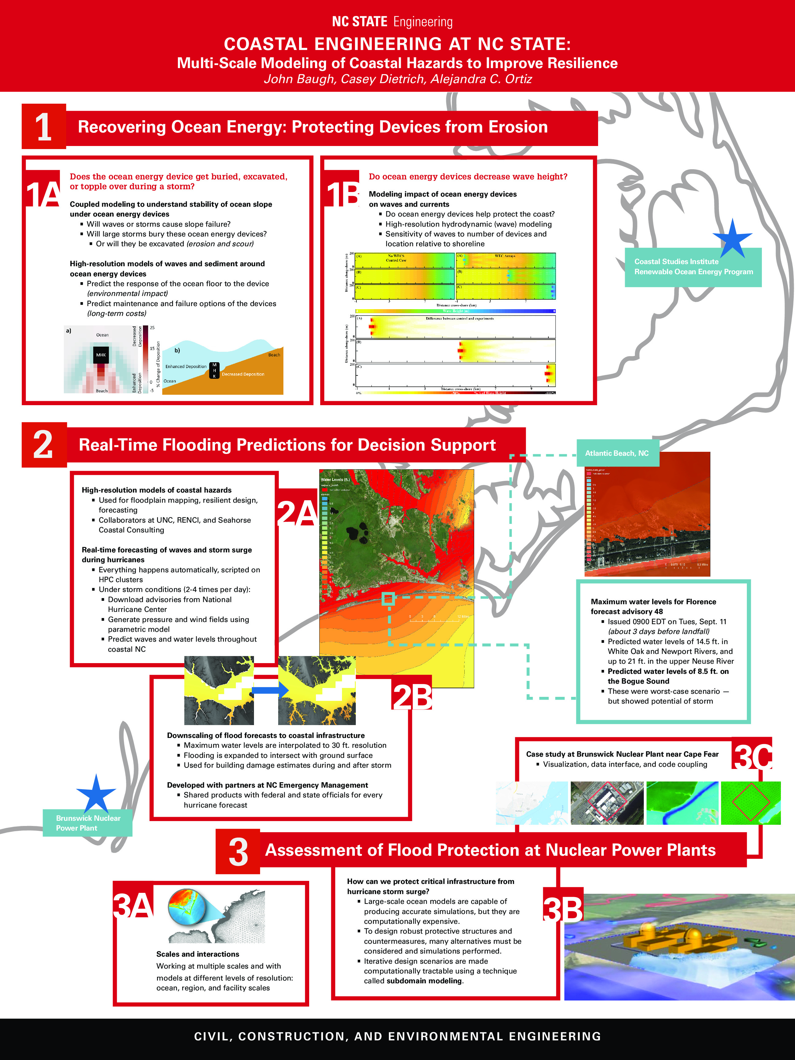
Non-comprehensive overview of coastal engineering research at NC State.
Updated 2020/06/24: Added documentation for --growradius none option.
Updated 2020/04/15: Added documentation for DEM vertical unit conversions.
The ADCIRC modeling system is used often to predict coastal flooding due to tropical cyclones and other storms. The model uses high resolution to represent the coastal environment, including flow pathways (inlets, man-made channels, rivers) and hydraulic controls (barrier islands, raised features). However, due to the use of large domains to represent hazards on coastlines in an entire state or multiple states, the highest resolution is typically about 20 to 50 m in coastal regions. Thus, there is a potential gap between the flooding predictions and the true flooding extents. We have developed a geospatial software to downscale the flooding extents to higher resolution.
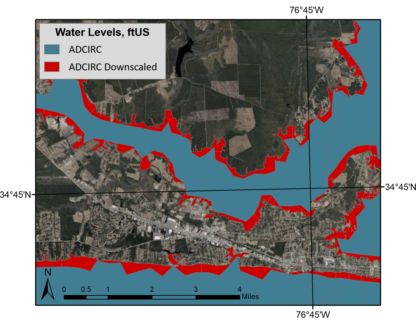
ADCIRC vs. downscaled water levels, plan view. This image shows the difference in prediction of flooding extents, with the blue portion representing the original ADCIRC flooding extents and red representing the downscaled extents.
The following documentation is for downscaling the flooding predictions by using Kalpana. This software was created originally to view ADCIRC outputs as either ESRI shapefiles or KML files (for viewing in Google Earth). ADCIRC (the ADvanced CIRCulation model) uses finite element methods to predict water levels throughout the modeled domain. Although this model is able to provide accurate predictions in a matter of minutes, these predictions have a limited resolution and are not able to provide information at the scale of buildings, roadways, and other critical infrastructure.
 In 2017, Hurricanes Harvey, Irma, and Maria caused more than $200 billion dollars of damage in the United States, as well as the incalculable cost of the loss of life and mental trauma associated with these disasters. In a changing climate, sea level rise and the potential for increasing tropical cyclone intensity can result in even more devastating damages. Therefore, engineers, community planners, and coastal residents need accurate, timely, and accessible forecasting of storm processes and their impact on coastal communities to bolster national resilience and reduce risk to life and property during these events. However, along with uncertainties in understanding and modeling of storm processes, there are complex challenges associated with determining and meeting the needs of end users who rely on these forecasts for emergency management decisions.
To determine needed advancements in storm forecasting, the U.S. Coastal Research Program (USCRP) hosted a Storm Processes and Impacts workshop for coastal stakeholders 16-18 April 2018, in St. Petersburg, Florida. The attendees included local coastal managers, emergency managers, state and regional agencies, federal agency scientists and engineers, academics, and private industry scientists and engineers. Workshop objectives were to synthesize present capabilities for modeling storm processes and forecasting impacts and to prioritize advancements. In addition, the workshop provided an opportunity to bridge the apparent gap between the research of coastal scientists and engineers and the information being distributed publicly and to emergency managers before, during, and after storm events.
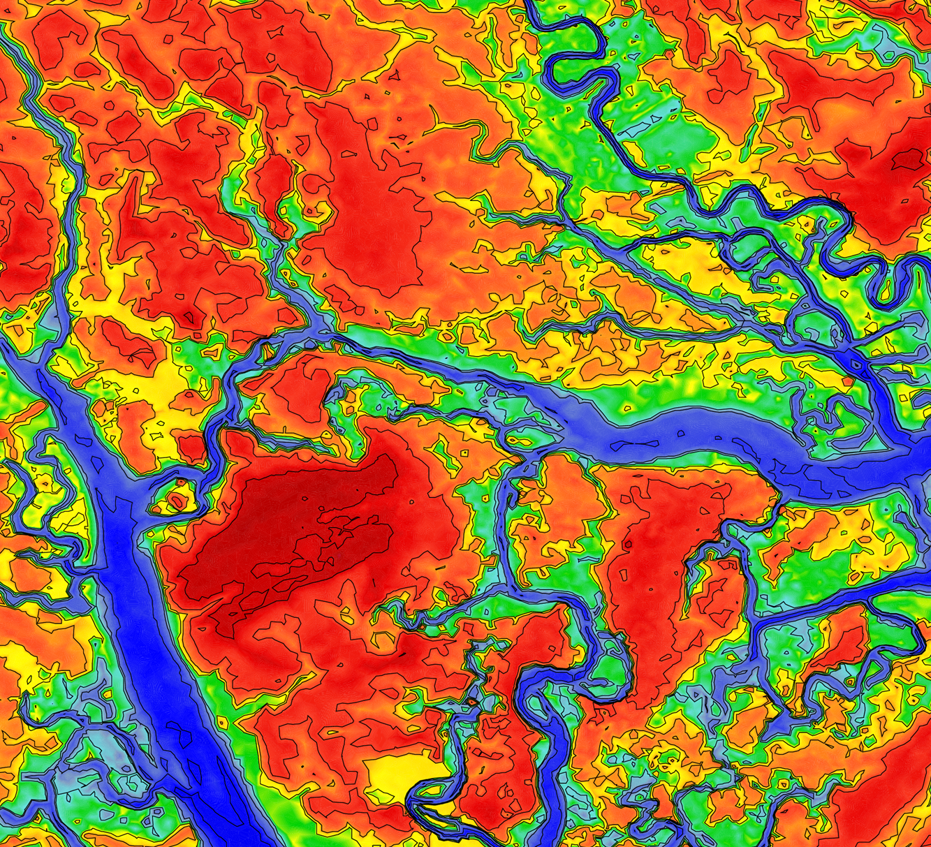
We should share more pretty images from our research, including this image of coastal floodplains and river channels. This is part of a larger mesh from Ajimon Thomas’s PhD work.
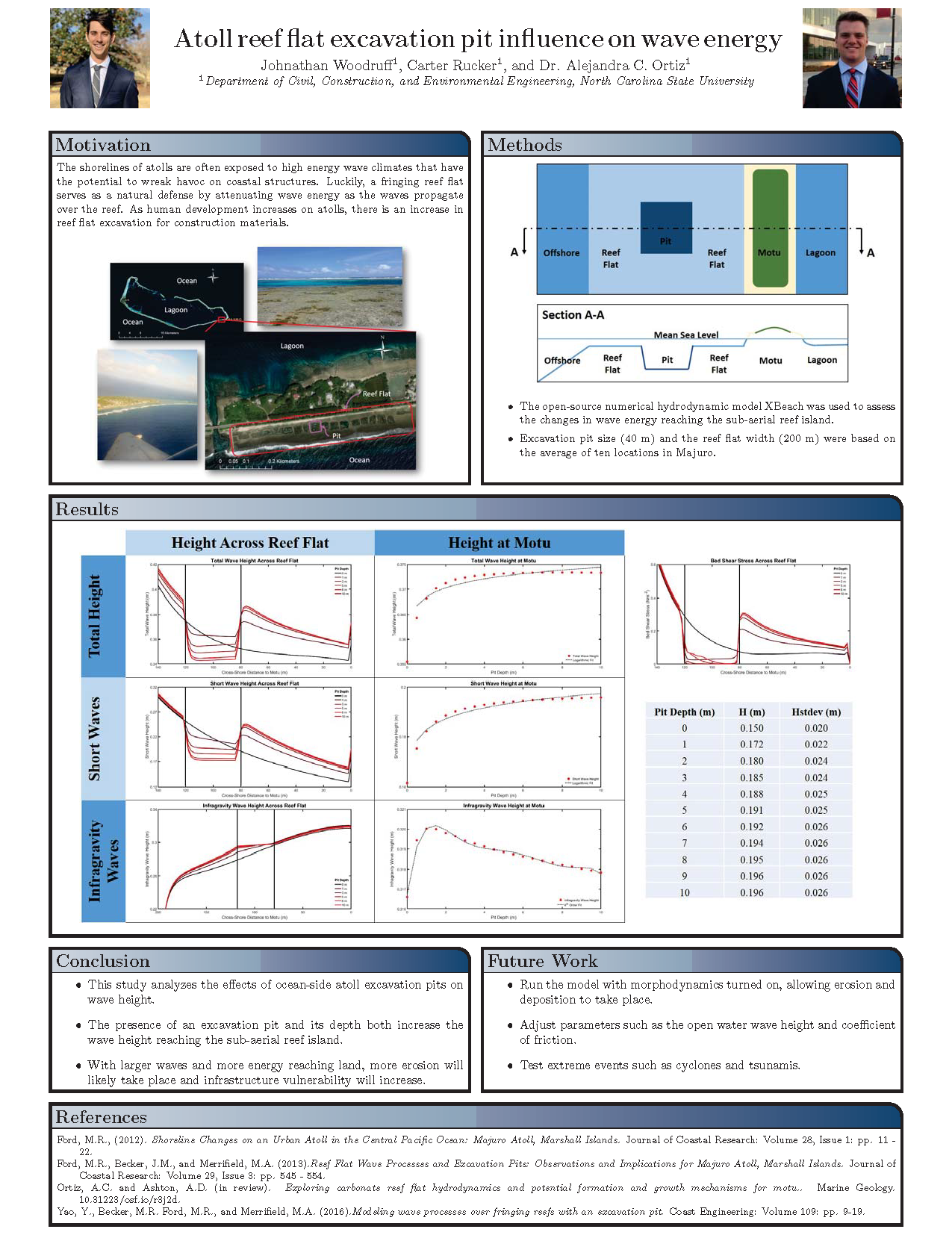
Atoll reef flat excavation pit influence on wave energy.