One of the most unpredictable and deadly parts of a coastal storm is the storm surge, which can cause devastating flooding of coastal regions, and can result in loss of property and life. Storm surge is a result of winds pushing water from the nearshore ocean to rise above regular tide levels. Storm surge can have a short duration; elevated water levels are limited to when the storm winds are strongest at the coast, typically for a few hours as the storm makes landfall. This short duration is a challenge for predictions of when storm surge will start, how long it will persist, and which regions will be flooded.
To predict storm surge and its associated flooding in coastal areas, numerical models must have a detailed representation of the impacted region, and thus be accurate, without having too much detail, which can limit efficiency. This research examines the use of a multi-resolution approach to improve both efficiency and accuracy. The key idea is that, as a storm travels across the ocean, it will affect different regions at different times. Early on, as the storm moves in open water and far from people, efficiency is more important in the model predictions. But as the storm moves toward the coast, it becomes necessary to have a higher accuracy near coastal communities and infrastructure. This research examines the use of multi-resolution simulations in which, as a storm travels along its track, the model ‘switches’ from lower resolution in open water to higher resolution as the storm moves closer to land. The main research question is to determine when is it most beneficial to switch resolutions by determining when storm effects are first seen at the coast.
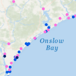
 This research will explore the arrival of storm effects for Florence, which made landfall along the North Carolina coast during September 2018. It is an ideal storm for this research as its track was shore-normal, and thus its coastal effects increased as it approached landfall. This will allow for investigating the most optimal switch by focusing on a single switch between a lower-resolution mesh to a higher-resolution mesh. The switches will be initiated by several triggers, including wind speeds and water levels at the coast and inland locations, and with several lead times, including near and several days before landfall. Model performance will be quantified via comparisons to observations of storm effects in the region, as well as to a single, high-resolution simulation for the full storm. It will be shown that switching from a coarse resolution mesh to a fine resolution mesh will lead to an increase in efficiency gains across all switching simulations with the most optimal switch time resulting in the most accurate predictions of water levels as compared to our full high-resolution simulation.
The results of this research will provide valuable contributions to forecasters working tirelessly during hurricane season to produce accurate and efficient predictions of coastal flooding impacts. With this information, real-time forecasts can be delivered sooner to emergency managers for informing evacuation zones, thus saving lives.
AC Poisson (2021). “Identifying the Earliest Signs of Storm Impacts to Improve Hurricane Flooding Forecasts,” North Carolina State University.


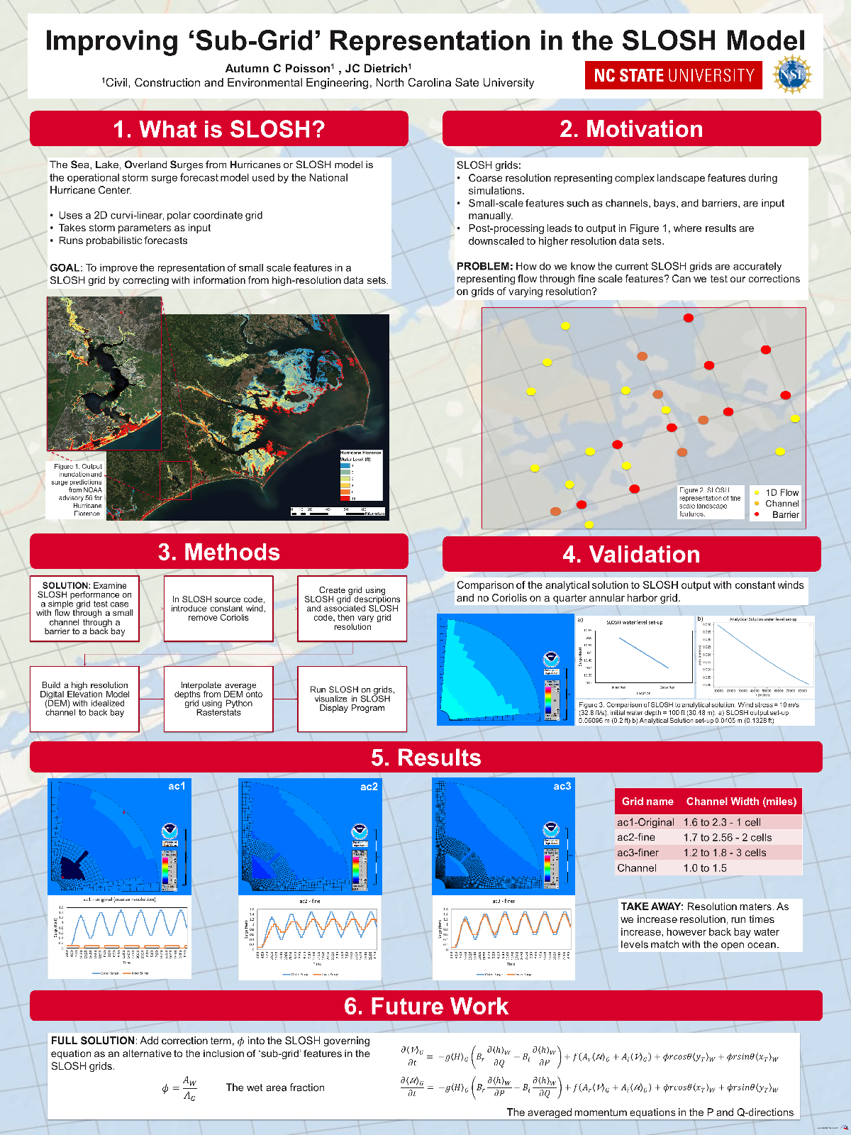
 Inundation models represent coastal regions with a grid of computational points, often with varying resolution of flow pathways and barriers. Models based on coarse grid solutions of shallow water equations have been improved recently via the use of subgrid corrections, which account for information (ground surface elevations, roughness characteristics) at smaller scales. In this work, numerical approaches of an established storm surge model are extended to include subgrid corrections. In an attempt to maintain continuity with existing users and results, model extensions were limited to those needed to provide basic subgrid capabilities, and included two major additions. First, a finite volume method is used to incorporate corrections to the mass and momentum equations using high-resolution ground surface elevations. Second, the no-slip condition imposed on the B-grid wet/dry interface in the model is modified to a slip condition to enable flows in channels with widths comparable to cell size. Numerical results demonstrate these numerical extensions can significantly enhance the accuracy of the model’s predictions of coastal flooding, with low additional computational cost.