Downscaling with Head Loss due to Land Cover in Kalpana

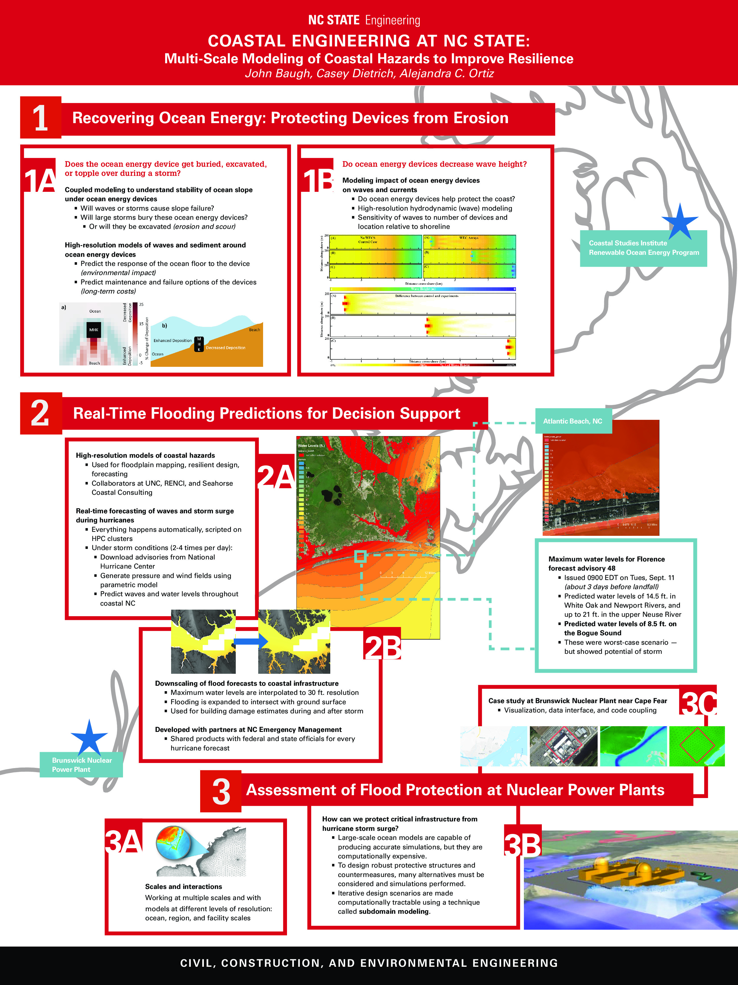
Originally developed as a tool for visualizing ADCIRC output, Kalpana has evolved to include methods for downscaling ADCIRC water elevation results. The first method, now referred to as the static method, extrapolated ADCIRC water elevations horizontally until intersecting an equivalent DEM elevation. More information about the static method and about downscaling ADCIRC results with Kalpana can be found on an earlier post.

The static method has proven to be a useful tool but incorporates minimal physics. Therefore, a new method, referred to as the head loss method, has been introduced to include energy dissipation due to land cover during overland flow events. In this page, we describe the theory of the head loss method and provide examples for how to apply it using Kalpana.

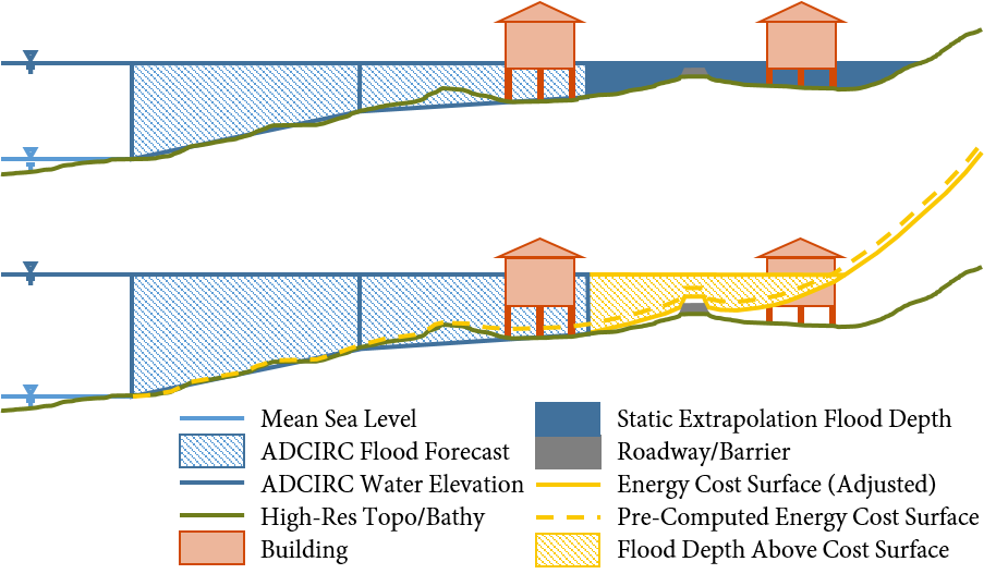
Side-view schematic of downscaling methods. A one-dimensional schematic is displayed for each of the two downscaling methods, where the top figure is the static method and the bottom is the head loss method. In the static method, the water elevations from ADCIRC (blue hatched portion) are extrapolated as a flat surface until they intersect the DEM. In the head loss method, these water elevations are extrapolated to an energy cost surface (elevation plus cumulative head loss).

Continue reading

Seminar: UNC Wilmington

Presentation: ASCE NC Fall Conference

News: Modeling Florence’s Storm Surge

2019/04/26 – NCSU College of Engineering
After the Storm

ncsu-engr

Dr. Casey Dietrich, an assistant professor in the Department of Civil, Construction, and Environmental Engineering (CCEE), leads the Coastal and Computational Hydraulics Team and develops computational models that predict storm surge and coastal flooding. Using the model ADCIRC, the team makes predictions about how high sea waters will rise, which areas will be flooded and for how long. These predictions are made for the entire coastline, and then his team visualizes the flooding at the scales of individual buildings and coastal infrastructure. During Florence, Dietrich’s team and collaborators acted as liaisons for state emergency managers to aid their decision making.

“The models are just one data point among many, but they’re helpful in understanding hazards and used to make predictions in real time — partly to make decisions about evacuation, where to deploy resources after, safe places to put emergency vehicles and water supplies,” he said.

The state emergency managers are able to use the flooding predictions to get immediate estimates on damages, which helps communities that are figuring out how much recovery will cost.

After Hurricane Matthew in 2016, Dietrich and his colleagues improved the models’ ability to forecast encroaching water along shorelines. Post-Florence, Dietrich said the research focus is to speed up the model and allow for more permutations to see what might happen if a storm slows down or shifts direction.

Chancellor’s Visit to CCEE Department

NCSU Chancellor Randy Woodson visited the CCEE Department to learn more about our research in resilient infrastructure. The visit was organized as a poster session, with overviews of research from 10 faculty teams in related areas. Casey Dietrich presented an overview of the coastal engineering research, with help from Alejandra Ortiz and John Baugh.

Non-comprehensive overview of coastal engineering research at NC State.

Continue reading

Seminar: Coffee & Viz

Seminar: Geospatial Forum