

XBeach Model Predicts Storm Impacts on Beaches and Dunes
Alireza Gharagozlou (below) is a doctoral student in the Department of Civil, Construction, and Environmental Engineering at NC State University. He studies how to connect predictions of beach and dune erosion to community-wide flooding and serves with Casey Dietrich on NC State’s Coastal & Computational Hydraulics Team. North Carolina Sea Grant has supported their work.
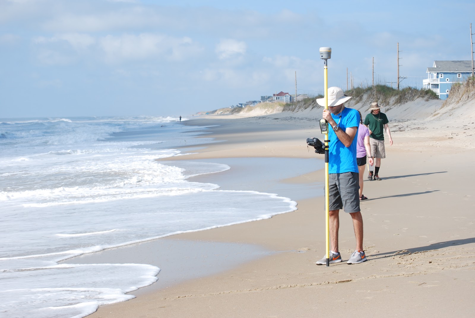
Alireza surveying the beach profile near Hatteras, NC, with RTK-GPS after Hurricane Florence.
2019/04/26 – NC Sea Grant Coastwatch Currents
Model Predicts Storm Impacts on Beaches and Dunes

During storms, strong waves and currents can erode beaches and dunes and create low-lying areas vulnerable to flooding. We use field surveys and a computer model called XBeach to predict this erosion, as well as to understand its interactions with storm-driven flooding of larger regions.
Computer models allow us to see how the storm surge and waves impact the beach over time, and which locations are vulnerable to large-scale damage. Good predictions of such storm impacts help emergency managers take better-informed measures to protect coastal areas. Understanding vulnerabilities also instructs highway access design and residential area planning.
We used the XBeach computer model on more than 30 kilometers of Hatteras Island between Avon and Rodanthe to explore how to connect erosion predictions to larger areas. Could XBeach cover more of the island, yet still provide good erosion predictions at beach and dune scales? And how could we connect erosion predictions to other models for storm surge and flooding?

 The amount and extent of coastal flooding caused by hurricanes can be sensitive to the timing or speed of the storm. For storms moving parallel to the coast, the hazards can be stretched over a larger area. Hurricane Matthew was a powerful storm that impacted the southeastern U.S. during October 2016, moving mostly parallel to the coastline from Florida through North Carolina. In this study, three sources for atmospheric forcing are considered for a simulation of Matthew’s water levels, which are validated against extensive observations, and then the storm’s effects are explored on this long coastline. It is hypothesized that the spatial variability of Matthew’s effects on total water levels is partly due to the surge interacting nonlinearly with tides. By changing the time of occurrence of the storm, differences in storm surge are observed in different regions due to the storm coinciding with other periods in the tidal cycles. These differences are found to be as large as 1m and comparable to the tidal amplitude. A change in forward speed of the storm also should alter its associated flooding due to differences in the duration over which the storm impacts the coastal waters. With respect to the forward speed, the present study contributes to established results by considering the scenario of a shore-parallel hurricane. A faster storm caused an increase in peak water levels along the coast but a decrease in the overall volume of inundation. On the other hand, a slower storm pushed more water into the estuaries and bays and flooded a larger section of the coast. Implications for short-term forecasting and long-term design studies for storms moving parallel to long coastlines are discussed herein.