To enhance the forecasting of wave, surge sediment transport (erosion and accretion above and below mean sea level), structure interaction and damage, we propose to heavily leverage our existing forecasting capability and experience operating the ADCIRC Prediction System (APS). We will enhance the current APS for surge, wave and inundation calculations, interface APS with the XBeach model to better represent nearshore and cross-shore wave processes and accompanying inundation and to predict sediment transport associated with the storm events. Wave and water level information from both APS and from XBeach will then be used to predict structure interaction and damage. Our efforts will focus on implementation and evaluation of our modeling system for hindcast events and/or for reanalysis of forecast events. Then we will utilize meteorological forcing to produce a daily forecast of coastal impacts beginning five days prior to landfall for at least three named hurricanes per year. These runs will be deterministic, commensurate with our approach to forecasting surge, wave and inundation from tropical cyclones in the APS. Given this experience, we are confident we will meet the forecast objectives of the NOPP community approach to model evaluation and improvement.
RA Luettich, MV Bilskie, BO Blanton, Z Cobell, DT Cox, JC Dietrich, JG Fleming, I Ginis. “Forecasting Coastal Impacts from Tropical Cyclones along the US East and Gulf Coasts using the ADCIRC Prediction System.” Department of Defense, Office of Naval Research, National Oceanographic Partnership Program (NOPP), Predicting Hurricane Coastal Impacts FY21-24, 2021/04/06 to 2025/04/05, $1,400,000 (Dietrich: $295,000).


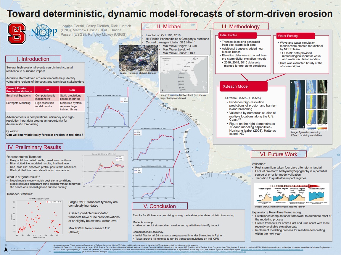
 Barrier islands are a primary coastal defense and often experience erosion during storms. When they fail due to storm-induced breaching, there can be significant changes to the small- and large-scale hydrodynamics and morphodynamics of the region. In this study, we explore the formation of a breach on Hatteras Island, North Carolina, during Isabel (2003) and the subsequent flooding into Pamlico Sound. Two-way coupling of high-fidelity, high-resolution numerical models for coastal erosion and flooding enables a better understanding of the formation of the breach, as well as scenarios of the breach’s effects on the circulation in the region. The breach connecting the ocean to the sound formed during the day of landfall. It is shown that, during the storm, overwash and inundation from the ocean led to deterioration of the beach and dunes, and then after the storm, the creation of channels through the island was sensitive to elevated water levels in the lagoon. Then flooding scenarios are considered in which the ground surface of the hydrodynamic model was (a) static, updated with the (b) pre- and post-storm observations, and updated dynamically with (c) erosion model predictions and (d) erosion model predictions with elevated lagoon-side water levels. The model results show that the breach has region-scale effects on flooding that extend 10 to 13 km into the lagoon, increasing the local water levels by as much as 1.5 m. These results have implications for similar island-lagoon systems threatened by storms.