

Tag Archives: Casey Dietrich
Conference: ASBPA Coastal Conference 2022
Emulator for Eroded Beach and Dune Profiles due to Storms
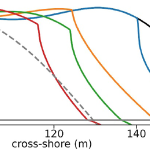 Dunes and beaches are vulnerable to erosion during storm events. Numerical models can predict beach response to storms with fidelity, but their computational costs, the domain-specific knowledge necessary to use them, and the wide range of potential future storm and beach conditions can hinder their use in forecasting storm erosion for short- and long-term horizons. We develop an emulator, which is an efficient predictive model that behaves like a numerical model, to predict the morphologic response of the subaerial beach to storms. Specific emphasis is placed on providing antecedent beach states as an input to the emulator and predicting the post-storm profile shape. Training data include beach profiles at multiple stages in a nourishment life cycle to assess if such a framework can be applied in locations that nourish as a coastal defense policy. Development and application of the emulator is focused on Nags Head, North Carolina, which nourishes its beaches to mitigate hazards of storm waves, flooding, and erosion. A high-fidelity, process-based morphodynamic model is used to train the emulator with 1250 scenarios of sea-storms and beach profiles. The post-storm beach state is emulated with a parameterized power-law function fit to the eroded portion of the subaerial profile. When the emulator was tested for a sequence of real storms from 2019, the eroded beach profiles were predicted with a skill score of 0.66. This emulator is promising for future efforts to predict storm-induced beach erosion in hazard warnings or adaptation studies.
Alireza and Carter are NCSU Graduates
The CCHT celebrated the graduations of Alireza Gharagozlou and Carter Howe!
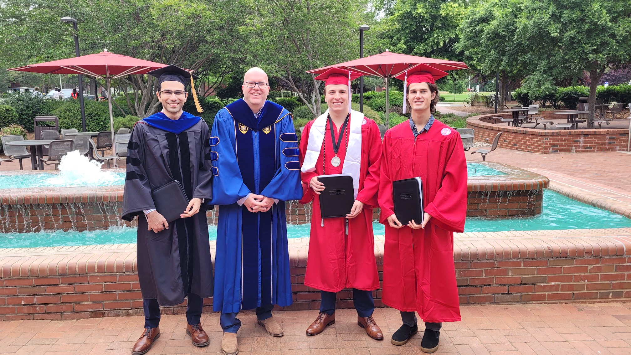
Alireza is now a coastal engineer with Taylor Engineering, Inc., and Carter will start his MS studies at Oregon State University. We also celebrated the graduation of Vega Sproul, who was an intern at the Coastal Studies Institute and then an undergraduate researcher with Dr. Beth Sciaudone. We are extremely proud of them!
From left to right: Alireza Gharagozlou, Casey Dietrich, Carter Howe, and Vega Sproul celebrate graduation.
Webinar: USCRP Progress Review
Team Photo 2022
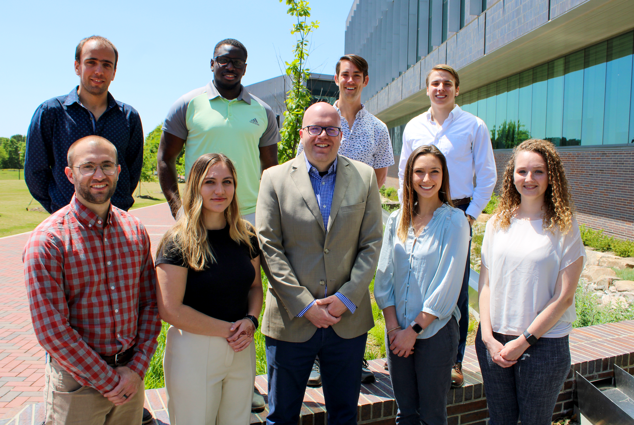
Front (left to right): Dylan Anderson, Sydney Crisanti, Casey Dietrich, Jessica Gorski, Brooke Rumbaugh. Back (left to right): Tomás Cuevas López, Jenero Knowles, Johnathan Woodruff, Carter Howe. Not pictured: Carter Day.
Comparative Assessment of Total Water Levels for Coastal Military Facility Readiness and Resilience using Numerical Models
This project will compare numerical and empirical model predictions of coastal flooding at representative military facilities, with the goal of identifying the best practice for any facility. Unlike previous efforts, this project will consider a suite of open-source numerical models, which include all of the relevant physics that contribute to total water levels, such as sea level rise, tides, wind-induced surge, wave runup, and infragravity motions. Total water levels will be predicted for selected tropical cyclones and storm events with varying tracks and intensities, to represent the full range of possible forcings at each location. Locations include facilities on the U.S. Gulf and Atlantic coasts and in the Pacific Ocean to represent the full range of coastal geographies. Model performance will be compared with respect to inundation depths, timing and duration of flooding at each installation, as well as computational costs. This comparative assessment will inform the use of the most appropriate model in terms of resolved physics and computational effort for predictions of total water levels at any facility, thus enhancing military installation readiness and resilience, in direct support of DoD and ESTCP priorities.
JA Puleo, JC Dietrich, J Figlus, K Nederhoff, F Shi, SM Smallegan, CD Storlazzi, A van Dongeren. “Comparative assessment of total water levels for coastal military facility readiness and resilience using numerical models.” Department of Defense, Environmental Security Technology Certificate Program, 2022/04/13 to 2026/04/12, $2,177,000 (Dietrich: $346,000).