

Category Archives: SWAN
Presentation: NSF Workshop 2018
Conference: ADCIRC 2018
Poster: Graduate Student Research Symposium 2018
A Thomas, JC Dietrich, JG Fleming, BO Blanton, T Asher, RA Luettich. “High-Resolution Modelling of Surge during Hurricane Matthew (2016).” Graduate Student Research Symposium, North Carolina State University, 21 March 2018.
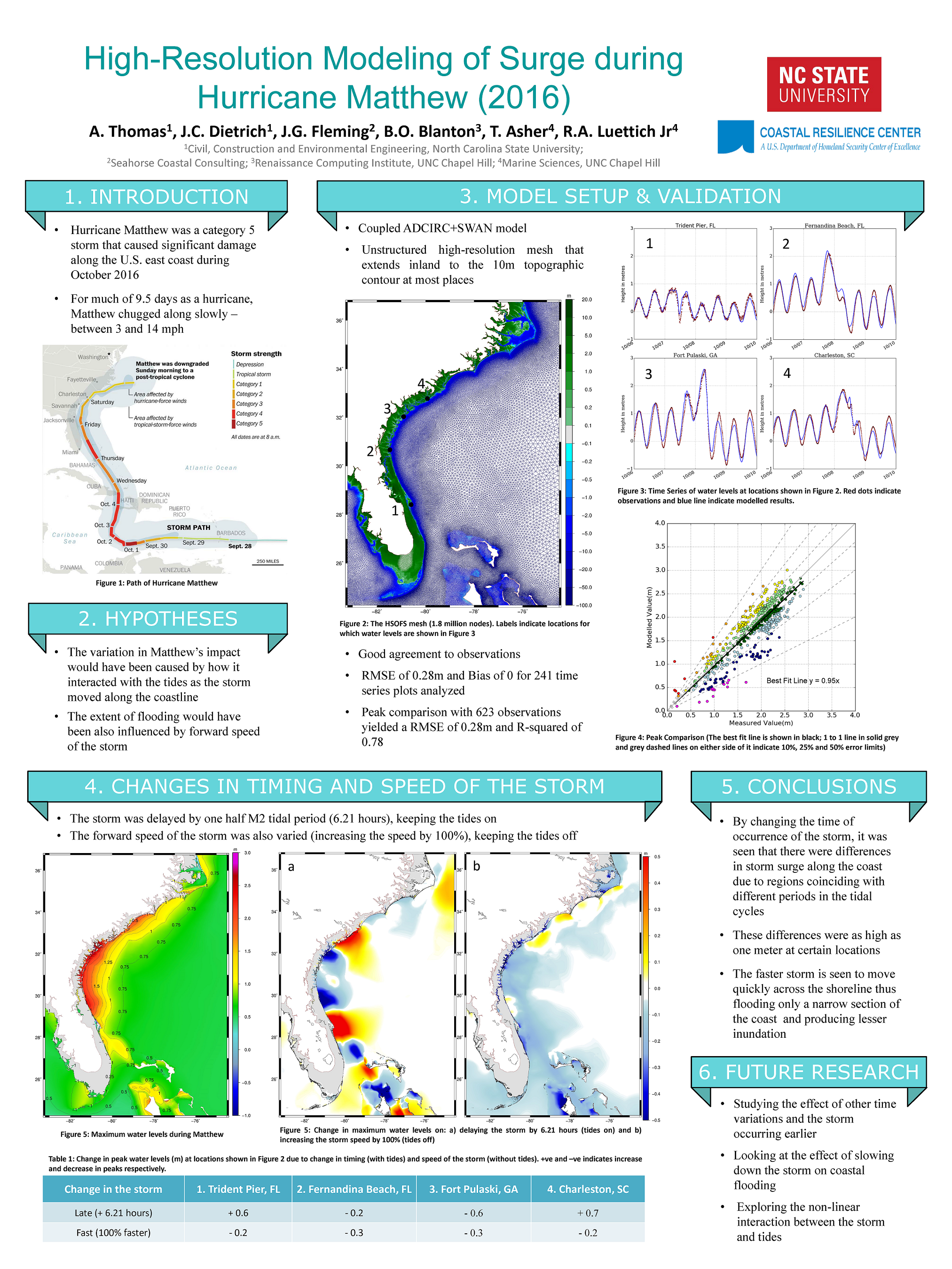
High-Resolution Modelling of Surge during Hurricane Matthew (2016).
Posters: EWC Research Symposium 2018
N Tull, JC Dietrich, TE Langan, H Mitasova, BO Blanton, JG Fleming, RA Luettich. “Improving Accuracy of Real-Time Storm Surge Inundation Predictions.” Environmental, Water Resources, and Coastal Engineering Research Symposium, North Carolina State University, 2 March 2018.
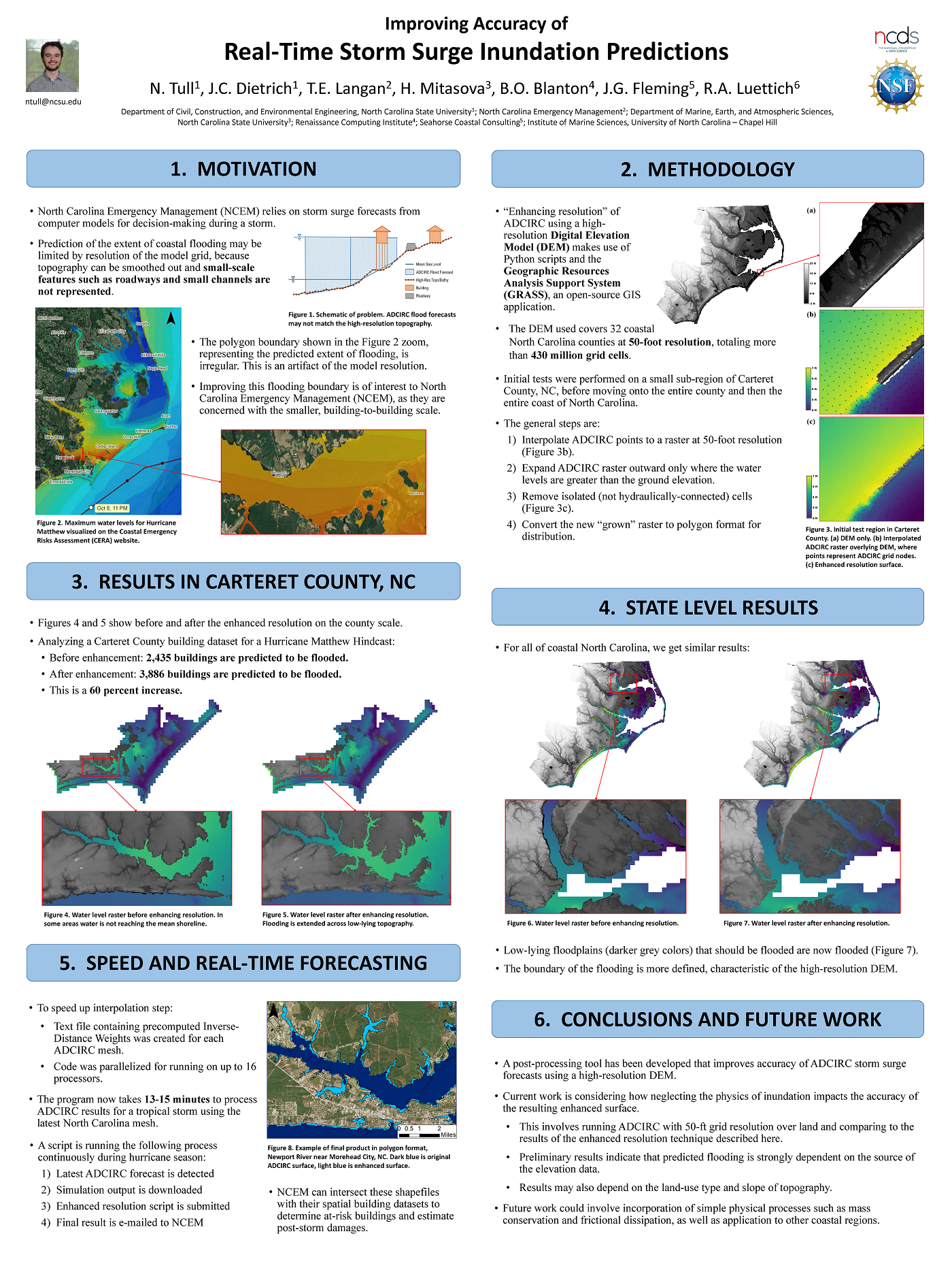
Improving Accuracy of Real-Time Storm Surge Inundation Predictions.
Sensitivity of Storm Surge Predictions to Atmospheric Forcing during Hurricane Isaac
 Storm surge and overland flooding can be predicted with computational models at high levels of resolution. To improve efficiency in forecasting applications, surge models often use atmospheric forcing from parametric vortex models, which represent the surface pressures and wind fields with a few storm parameters. The future of storm surge prediction could involve real-time coupling of surge and full-physics atmospheric models; thus, their accuracies must be understood in a real hurricane scenario. The authors compare predictions from a parametric vortex model (using forecast tracks from the National Hurricane Center) and a full-physics coupled atmosphere-wave-ocean model during Hurricane Isaac (2012). The predictions are then applied within a tightly coupled, wave and surge modeling system describing the northern Gulf of Mexico and the floodplains of southwest Louisiana. It is shown that, in a hindcast scenario, a parametric vortex model can outperform a data-assimilated wind product, and given reasonable forecast advisories, a parametric vortex model gives reasonable surge forecasts. However, forecasts using a full-physics coupled model outperformed the forecast advisories and improved surge forecasts. Both approaches are valuable for forecasting the coastal impacts associated with tropical cyclones