News: National Consortium for Data Science chooses Data Fellows

ncds2016/04/28 – NCDS
National Consortium for Data Science chooses researchers from three universities as 2016 -2017 Data Fellows

Three researchers located at Drexel University, North Carolina State University, and the University of North Carolina at Chapel Hill have been named 2016 -2017 Data Fellows by the National Consortium for Data Science (NCDS) the consortium announced today.

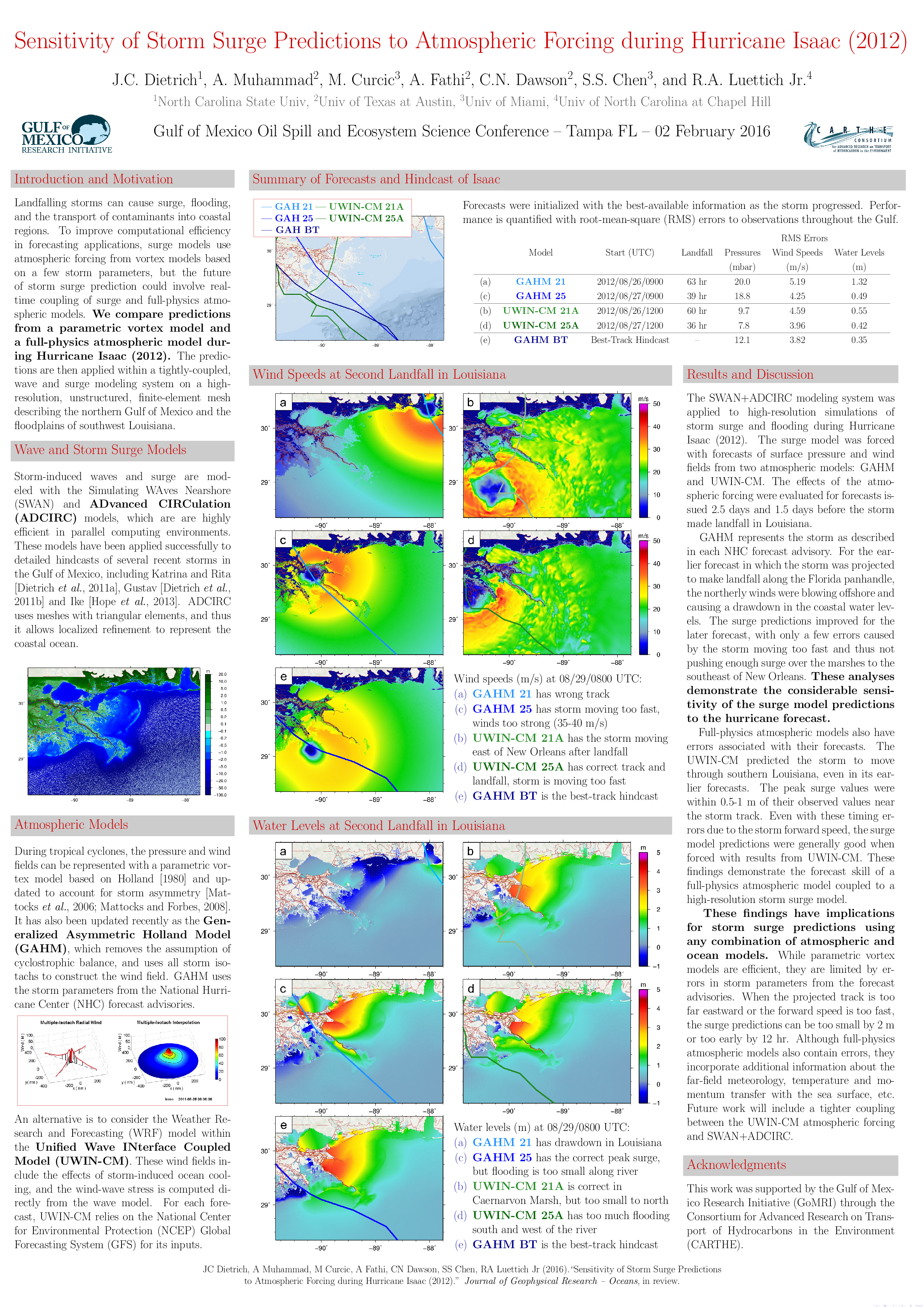
Researchers in North Carolina use the Advanced CIRCulation (ADCIRC) model to provide real-time information about storm surge, water inundation, wind speeds, and wave heights during coastal storms. These models are produced constantly during major storms, however, communicating the information in the simulations to end users, such as emergency managers, is more challenging. This project will use visualization techniques to bring ADCIRC model data to emergency managers so they can quickly identify, analyze, and disseminate information about high-risk areas. By incorporating the model data with other data sources, the researchers hope to enable informed decision-making about evacuations and other disaster management efforts.

Interactions between Waves, Flooding and Beach Morphology during Storm Events

Our goal is to improve simulations of coastal flooding in regions where the beach morphology is highly dynamic during a storm event. The feedback between waves, surge and morphology must be better linked, specifically through the extension and coupling of state-of-the-art numerical models. Although most morphology models are limited in their geographic extents, we will extend and apply a process-driven model to represent erosion and breaching at larger scales. And, although most wave, surge and morphology models are coupled with one-way communication, we will develop an automated system to map information in both ways. This research will produce modeling technologies that will benefit coastal communities within North Carolina, and we will share these technologies and findings with stakeholders. Simulations of wave propagation and flooding (and specifically the simulations from our models) are used in North Carolina and elsewhere for building design, the establishment of flood insurance rates, and real-time decision support during storm events. These predictions will be strengthened via the proposed tight coupling with a beach morphology model. The resulting modeling system will better represent the nearshore response to storm impacts.

JC Dietrich, MF Overton, RA Luettich Jr. “Interactions between Waves, Flooding and Beach Morphology during Storm Events.National Oceanic and Atmospheric Administration, North Carolina Sea Grant, 2015/07/02, $98,225 (Dietrich: $88,378).

Improving the Efficiency of Wave and Surge Models via Adaptive Mesh Resolution

The goal of this project is to improve the efficiencies of the widely-used SWAN+ADCIRC models for hurricane waves and storm surge. This goal will be achieved through the use of adaptive mesh resolution and dynamic redistribution of the computational load across multiple processing cores. The objectives of the research are to (a) optimize the computational workload of storm surge calculations by modifying adaptively the mesh resolution as dictated by storm track and cone of uncertainty, and (b) to do so in a way that does not sacrifice parallel efficiency.

RA Luettich Jr, G Smith, et al. “Coastal Resilience Center of Excellence at UNC.Department of Homeland Security, Science and Technology Directorate, 2016/01/01 to 2020/06/30, (Dietrich: $470,000).