

SG Lott, JC Dietrich, EL Seekamp, AJ Ross. “Modeling storm surge flooding for participatory transformation of barrier islands: Hatteras Island, NC, USA.” ADCIRC Users Group Meeting, Vicksburg, Mississippi, 12 May 2025.
Modeling storm surge flooding for participatory transformation of barrier islands: Hatteras Island, NC, USA.
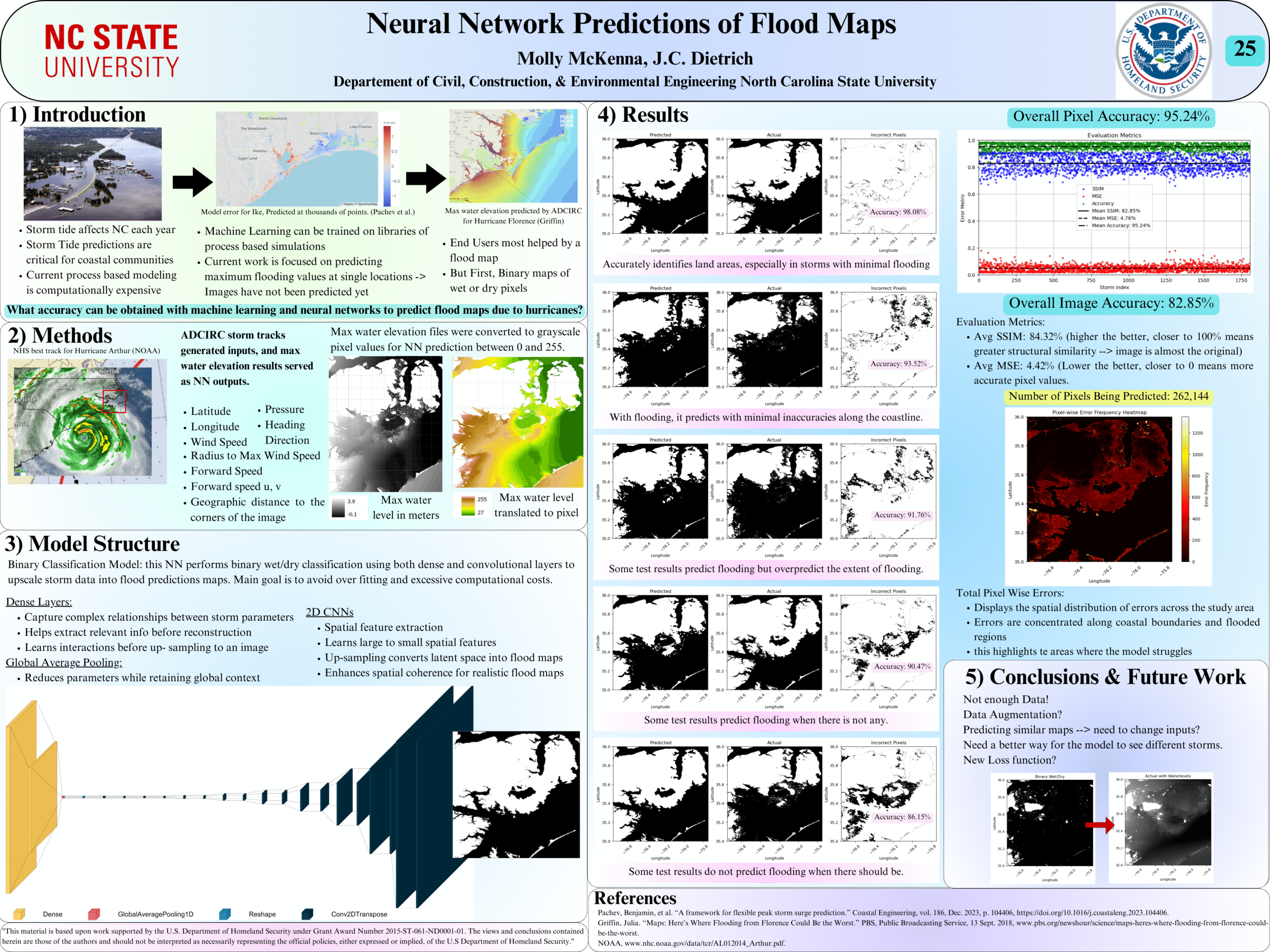
Neural Network Predictions of Flood Maps
Baroclinic 3D modeling of circulation patterns in the Pamlico-Albemarle Sound System
 The U.S. Atlantic and Gulf of Mexico coasts are vulnerable to storms, which can cause significant erosion of beaches and dunes that protect coastal communities. Real-time forecasts of storm-driven erosion are useful for decision support, but they are limited due to demands for computational resources and uncertainties in dynamic coastal systems and storm forcings. Current methods for coastal change forecasts are based on empirical calculations for wave run-up and conceptual models for erosion, which do not represent sediment transport and morphological change during the storm. However, with continued advancements in high-resolution geospatial data and computational efficiencies, there is an opportunity to apply morphodynamic models for forecasts of beach and dune erosion as a storm approaches the coast. In this study, we implement a forecast system based on a deterministic, dynamic model. The morphodynamic model is initialized with digital elevation models of the most up-to-date conditions and forced with hydrodynamics from wave and circulation model forecasts, and its predictions are categorized based on impact to the primary dune, defined in this study as the first ridge of sand landward of the beach. Results are compared spatially to the observed post-storm topography using changes to dune crest elevations and volumes, and temporally to the predicted total water level at the forecasted moment of dune impact.

