These analyses were performed by Carter Day, an undergraduate researcher in our team.
Like other spectral wave models, SWAN uses parameterizations to represent sources (e.g. wind), sinks (e.g. whitecapping, bottom friction, depth-limited breaking), and resonance (e.g. quadruplet and triad wave-wave interactions). Each parameterization is based on laboratory and experimental data to represent the transfer of energy to, from, and between waves. It is necessary for each term to represent its physical process, but it is also necessary for the terms to be calibrated collectively to represent their combined effects on wave evolution.
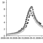
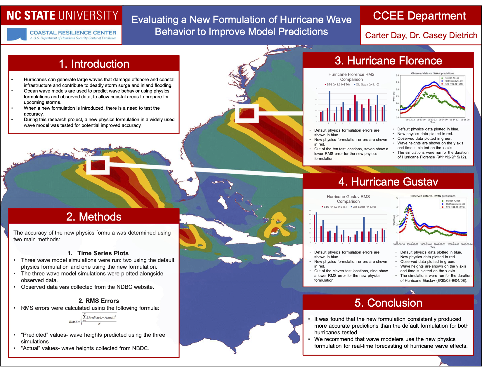
SWAN release version 41.31 was modified in two main ways: derivative computation was changed to use the Green-Gauss formula, and a new ‘package’ of wave physics (the so-called ST6 physics) was introduced. This package includes new parameterizations of wind input, whitecapping, swell dissipation, wind speed scaling, and other processes. The ST6 physics have been adopted by other wave models (e.g. NOAA’s WaveWatch III), and it will likely become the preferred physics package for SWAN. However, because the ST6 physics package has changes to so many parameterizations, it is necessary to quantify its effects on wave predictions during recent storms.
In this study, we simulate two recent hurricanes, Gustav (2008) and Florence (2018), and we compare wave predictions with the new ST6 physics package. Do the ST6 physics improve the SWAN wave predictions?
Continue reading →


 The Simulating WAves Nearshore (SWAN, Booij et al. 1999) model is used widely for predictions of waves in coastal regions. Like other spectral wave models, SWAN uses parameterizations to represent wave evolution due to sources (e.g. wind), sinks (e.g. whitecapping, bottom friction, depth-limited breaking), and resonance (e.g. quadruplet and triad wave-wave interactions). Each parameterization is based typically on observational data to represent the transfer of energy to, from, and between waves. It is necessary for each term to represent its physical process, but it is also necessary for the terms to be calibrated collectively to represent their combined effects on wave evolution. The calibrated wave predictions can then be coupled with models for circulation and coastal flooding, e.g. ADvanced CIRCulation (ADCIRC, Luettich et al. 1992).
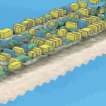 Hurricanes are devastating natural hazards that often cause damage to the built environment as a result of their loadings, which include storm surge, waves, and wind, often in combination. Modeling these hazards individually and their effects on buildings is a complex process because each loading component within the hazard behaves differently, affecting either the building envelope, the structural system, or the interior contents. Realistic modeling of hurricane effects requires a multihazard approach that considers the combined effects of wind, surge, and waves. Previous studies focused primarily on modeling these hazards individually, with less focus on the multihazard impact on the whole building system made up of the combination of the structure and its interior contents. The analysis resolution used in previous studies did not fully enable hurricane risk assessment through a detailed investigation of the vulnerability at the component-level or subassembly-level (a group of components such as interior contents, structural components, or nonstructural components). To address these research gaps, a robust multihazard hurricane risk analysis model that uses high-resolution hazard, exposure, and vulnerability models was developed. This model uses a novel approach to combine the storm surge and wave fragility functions with a suite of existing wind fragilities to account for structural damage and then combines them with another suite of flood-based fragilities to account for interior content damage. The proposed vulnerability model was applied to the state of North Carolina as an example of a regional-scale assessment to demonstrate the ability of the method to predict damage at the building level across this large spatial domain. This model enables better understanding of the damages caused by hurricanes in coastal regions, thereby setting initial post-impact conditions for community resilience assessment and investigation of recovery policy alternatives.