Downscaling with Head Loss due to Land Cover in Kalpana

Originally developed as a tool for visualizing ADCIRC output, Kalpana has evolved to include methods for downscaling ADCIRC water elevation results. The first method, now referred to as the static method, extrapolated ADCIRC water elevations horizontally until intersecting an equivalent DEM elevation. More information about the static method and about downscaling ADCIRC results with Kalpana can be found onĀ an earlier post.

The static method has proven to be a useful tool but incorporates minimal physics. Therefore, a new method, referred to as the head loss method, has been introduced to include energy dissipation due to land cover during overland flow events. In this page, we describe the theory of the head loss method and provide examples for how to apply it using Kalpana.
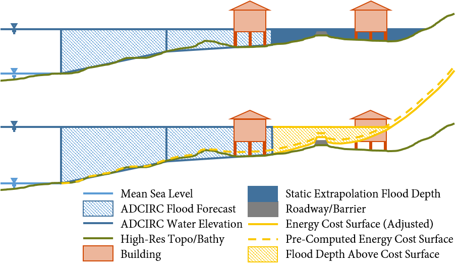
Side-view schematic of downscaling methods. A one-dimensional schematic is displayed for each of the two downscaling methods, where the top figure is the static method and the bottom is the head loss method. In the static method, the water elevations from ADCIRC (blue hatched portion) are extrapolated as a flat surface until they intersect the DEM. In the head loss method, these water elevations are extrapolated to an energy cost surface (elevation plus cumulative head loss).

Continue reading

Downscaling ADCIRC Flooding Inundation Extents Using Kalpana

Updated 2020/06/24: Added documentation for --growradius none option.

Updated 2020/04/15: Added documentation for DEM vertical unit conversions.

The ADCIRC modeling system is used often to predict coastal flooding due to tropical cyclones and other storms. The model uses high resolution to represent the coastal environment, including flow pathways (inlets, man-made channels, rivers) and hydraulic controls (barrier islands, raised features). However, due to the use of large domains to represent hazards on coastlines in an entire state or multiple states, the highest resolution is typically about 20 to 50 m in coastal regions. Thus, there is a potential gap between the flooding predictions and the true flooding extents. We have developed a geospatial software to downscale the flooding extents to higher resolution.

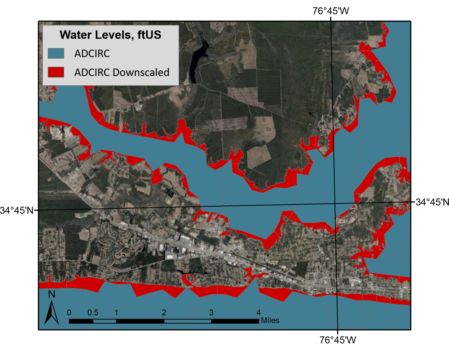
ADCIRC vs. downscaled water levels, plan view. This image shows the difference in prediction of flooding extents, with the blue portion representing the original ADCIRC flooding extents and red representing the downscaled extents.

The following documentation is for downscaling the flooding predictions by using Kalpana. This software was created originally to view ADCIRC outputs as either ESRI shapefiles or KML files (for viewing in Google Earth). ADCIRC (the ADvanced CIRCulation model) uses finite element methods to predict water levels throughout the modeled domain. Although this model is able to provide accurate predictions in a matter of minutes, these predictions have a limited resolution and are not able to provide information at the scale of buildings, roadways, and other critical infrastructure.

Continue reading