
Neural Network Predictions of Peak Storm Tides due to Tropical Cyclones
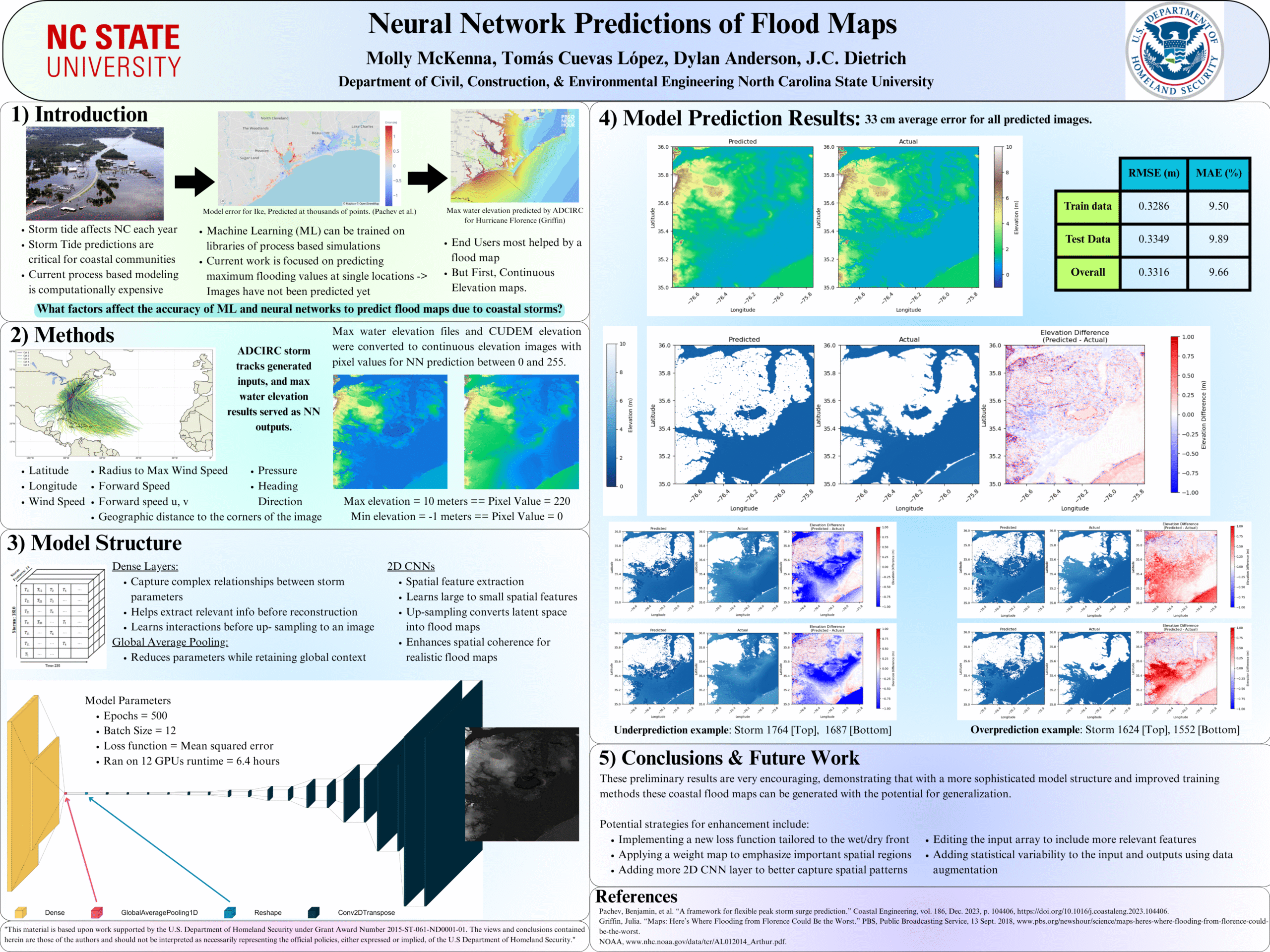
 Storm-driven flooding is a hazard for coastal communities. Process-based models can predict the combined effects of tides, winds, and flooding due to tropical cyclones, including in real-time, but often with restrictions due to a model’s runtime. Researchers have developed neural networks (NN), trained on libraries of storm surge simulations, to predict flooding in seconds. However, previous NNs ignored interactions with astronomical tides, limited to storms of specific durations, and trained for extreme conditions.
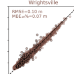
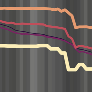
In this study, a NN is developed to predict peak values for storm tides (storm surge and tides) at nine stations along the North Carolina coast. For training, a library of storm-tides was developed via process-based model simulations of 1,813 synthetic storms based on historical data in the north Atlantic Ocean, but with a specific focus on North Carolina, and then augmented by a factor of 50 via combinations with random tides. Unlike previous NN, this approach incorporates the astronomical tides in the training and uses data augmentation techniques for enhanced generalization. The NN performs well, with root-mean-square errors of about 6 cm and mean bias errors for the extreme storms of about 5 cm. For probabilistic predictions of historical storms, the model can predict for 100 ensemble members in 1 sec, and the ranges of peak storm tides are close to their true values.
Resolution Sensitivities for Subgrid Modeling of Coastal Flooding
 Flooding due to storm surge can propagate through coastal regions to threaten the built and natural environments. This propagation is controlled by geographic features of varying scales, from the largest oceans to the smallest marsh channels and sandy dunes. Numerical models to predict coastal flooding have been improved via the use of subgrid corrections, which use information about the smallest-scale flow controls to provide corrections to coarser scale grids. Although previous studies have demonstrated the benefits of subgrid models, especially how coarser models can be more efficient without a trade-off in accuracy, this study systematically investigates subgrid corrections in storm surge models across large domains. Here, we apply the widely used ADVanced CIRCulation (ADCIRC) storm surge model with revised subgrid corrections to develop guidance for resolution of coastal regions. Recent hurricanes in the South Atlantic Bight are simulated with five models, each with varying resolution of coastal islands, estuaries, rivers, and floodplains. Model performance is quantified via comparisons with observed data and high-resolution simulations. Clear degradation is observed in the subgrid model performance as minimum mesh resolution becomes coarser than the width of channels conveying flow or the barrier islands blocking flow. Therefore, subgrid model mesh resolution should account for spatial scales of local flow pathways and barrier islands to maintain proper model mass and momentum transfer. However, with subgrid modeling this can be done at much coarser (and thus computationally faster) resolutions than with conventional models.
Community-Engaged Coastal Flood Modeling to Evaluate Sea Level Rise Adaptation Strategies
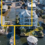 As sea levels continue to rise, coastal communities are searching for strategies to reduce flooding of low-lying roads, property, and stormwater drainage networks. Here we focus on the development of adaptation strategies for communities that experience flooding outside of extreme storms like hurricanes due to sea level rise (SLR). Processes that contribute to these floods can include tides, rainfall, wind setup, groundwater, and infrastructure failure (Gold et al., 2023). Here we present a framework to test the effectiveness of adaptation strategies in reducing multi-driver chronic flooding at both current and future sea levels. This framework integrates coastal engineering and stakeholder input to 1) identify adaptation strategies that are preferred by a community that frequently floods and 2) test the effectiveness of these strategies with a numerical model under both current and future conditions.
Sarah Grace selected as Global Change Research Fellow
 M.S. student Sarah Grace Lott was selected as a Global Change Research Fellow by the Southeast Climate Adaptation Science Center. Sarah Grace will participate in the 2025-2026 cohort and receive training and collaborate with students from across disciplines in climate science.
The fellowship program is designed to train the next generation of global change scientists by providing financial, scientific, and professional development support for graduate students who are interested in multi-disciplinary research. They come together across disciplines to discover, collaborate, and share their knowledge with diverse stakeholders. Learn more about the program at the SECASC web site.
Congratulations to Sarah Grace!
Posters: ADCIRC Users Meeting 2025
SG Lott, JC Dietrich, EL Seekamp, AJ Ross. “Modeling storm surge flooding for participatory transformation of barrier islands: Hatteras Island, NC, USA.” ADCIRC Users Group Meeting, Vicksburg, Mississippi, 12 May 2025.
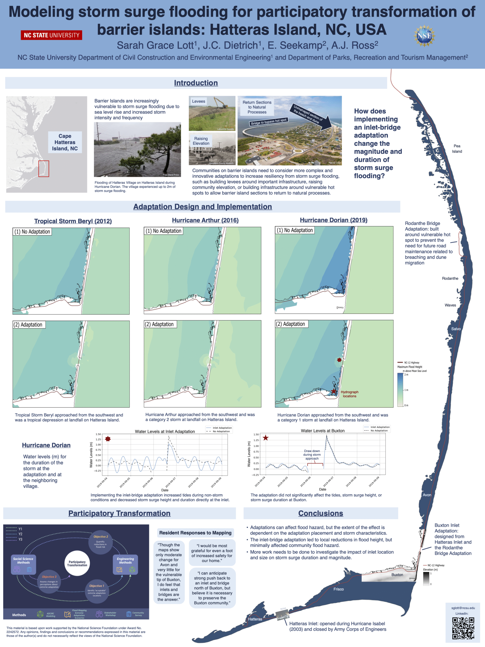
Modeling storm surge flooding for participatory transformation of barrier islands: Hatteras Island, NC, USA.
Neural Network Predictions of Flood Maps
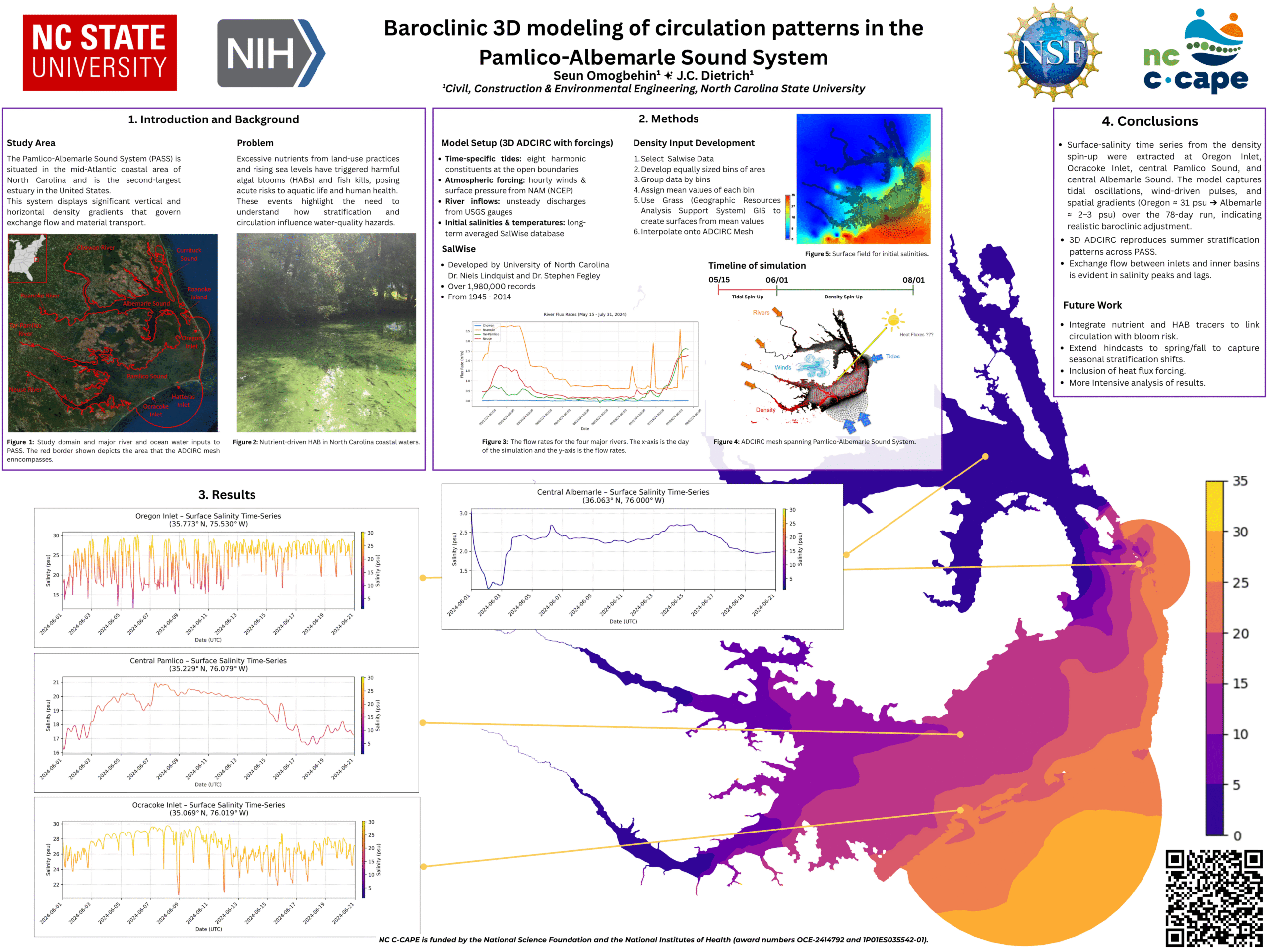
Baroclinic 3D modeling of circulation patterns in the Pamlico-Albemarle Sound System
Conference: ADCIRC Users Meeting 2025
Deterministic, Dynamic Model Forecasts of Storm‑Driven Coastal Erosion
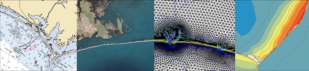
 The U.S. Atlantic and Gulf of Mexico coasts are vulnerable to storms, which can cause significant erosion of beaches and dunes that protect coastal communities. Real-time forecasts of storm-driven erosion are useful for decision support, but they are limited due to demands for computational resources and uncertainties in dynamic coastal systems and storm forcings. Current methods for coastal change forecasts are based on empirical calculations for wave run-up and conceptual models for erosion, which do not represent sediment transport and morphological change during the storm. However, with continued advancements in high-resolution geospatial data and computational efficiencies, there is an opportunity to apply morphodynamic models for forecasts of beach and dune erosion as a storm approaches the coast. In this study, we implement a forecast system based on a deterministic, dynamic model. The morphodynamic model is initialized with digital elevation models of the most up-to-date conditions and forced with hydrodynamics from wave and circulation model forecasts, and its predictions are categorized based on impact to the primary dune, defined in this study as the first ridge of sand landward of the beach. Results are compared spatially to the observed post-storm topography using changes to dune crest elevations and volumes, and temporally to the predicted total water level at the forecasted moment of dune impact.