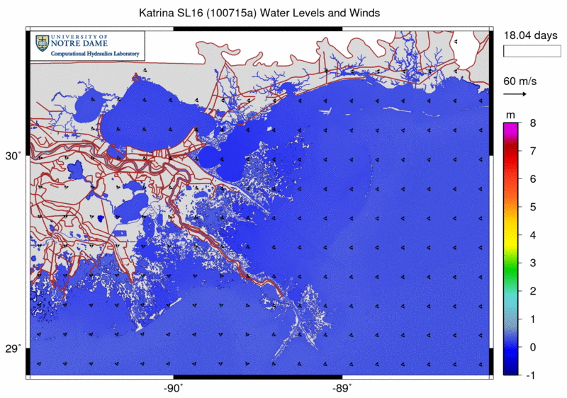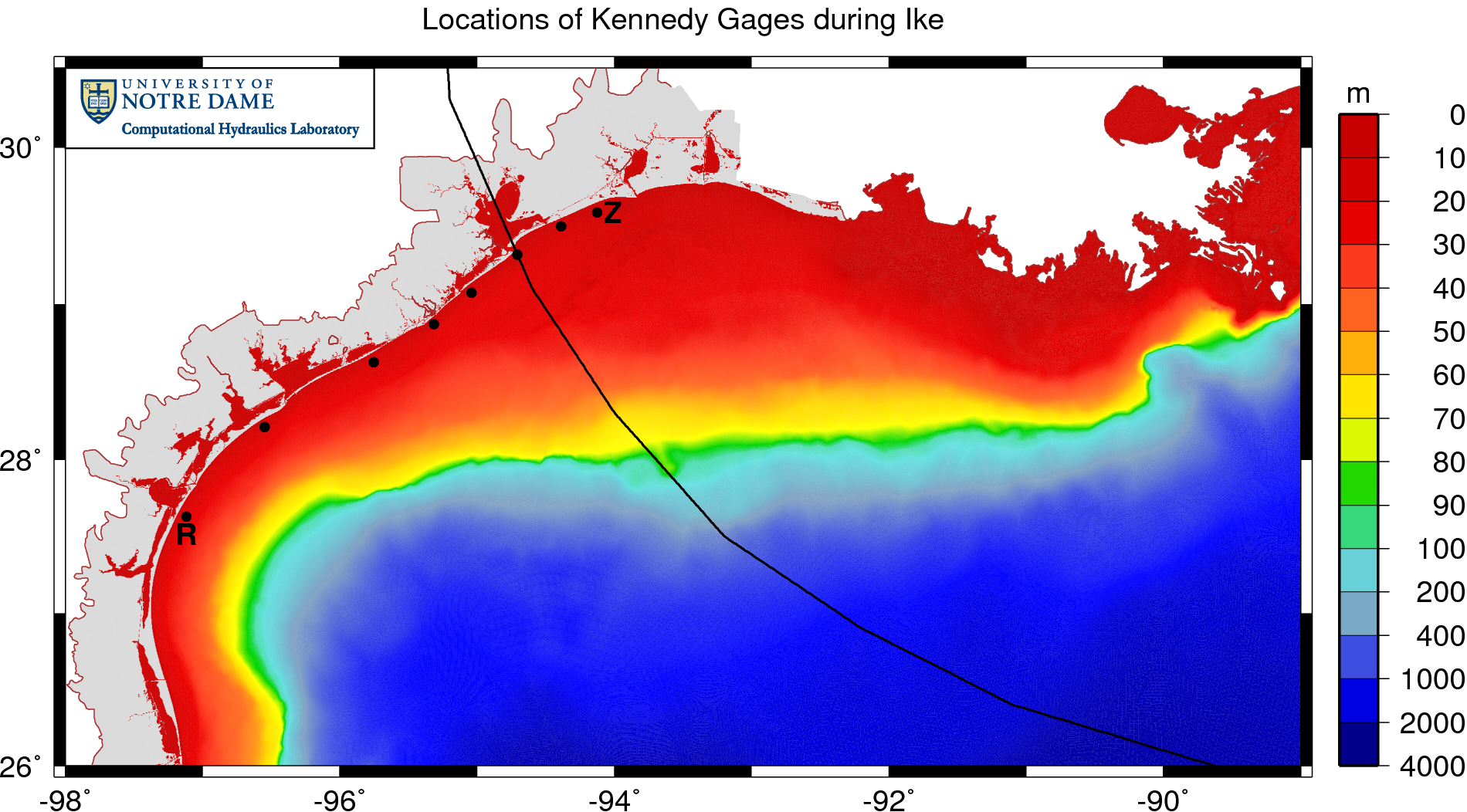
Coastal Louisiana and Mississippi are especially prone to large hurricanes due to their geographic location in the north-central Gulf of Mexico. Several recent hurricanes have devastated the region, creating complicated environments of waves and storm surge. Katrina (2005) and Gustav (2008) made landfall in southeastern Louisiana, and their counter-clockwise winds pushed surge onto the Louisiana-Mississippi continental shelf, into the low-lying wetlands surrounding the Mississippi River, and over and through the levee system that protects metropolitan New Orleans. Rita (2005) and Ike (2008) passed farther to the west, moved across the Texas-Louisiana continental shelf, and created surge that flooded large portions of southwestern Louisiana.
These hurricanes demand detailed hindcasts that depict the evolution of waves and surge during these storm events. These hindcasts can be used to map the likely floodplains for insurance purposes, to understand how the current protection system responded during each storm, and to design a new protection system that will resist better the waves and surge. In addition, the resulting computational model can be used to forecast the system’s response to future storm events.
The work described herein represents a significant step forward in the modeling of hurricane waves and surge in complicated nearshore environments. The system is resolved with unprecedented levels of detail, including mesh sizes of 1km on the continental shelf, less than 200m in the wave breaking zones and inland, and down to 20-30m in the fine-scale rivers and channels. The resulting hindcasts are incredibly accurate, with close matches between the modeled results and the measured high-water marks and hydrograph data. They can be trusted to provide a faithful representation of the evolution of waves and surge during all four hurricanes.
This work also describes advancements in the coupling of wave and surge models. This coupling has been implemented typically with heterogeneous meshes, which is disadvantageous because it requires intra-model interpolation at the boundaries of the nested, structured wave meshes and inter-model interpolation between the wave and circulation meshes. The recent introduction of unstructured wave models makes nesting unnecessary. The unstructured-mesh SWAN wave and ADCIRC circulation models are coupled in this work so that they run on the same unstructured mesh. This identical, homogeneous mesh allows the physics of wave-circulation interactions to be resolved correctly in both models. The unstructured mesh can be applied on a large domain to follow seamlessly all energy from deep to shallow water. There is no nesting or overlapping of structured wave meshes, and there is no inter-model interpolation. Variables and forces reside at identical, vertex-based locations. Information can be passed without interpolation, thus reducing significantly the communication costs.
The coupled SWAN+ADCIRC model is highly scalable and integrates seamlessly the physics and numerics from deep ocean to shelf to floodplain. Waves, water levels and currents are allowed to interact in complex problems and in a way that is accurate and efficient to thousands of computational cores. The coupled model is validated against extensive measurements of waves and surge during the four recent Gulf hurricanes. Furthermore, the coupling paradigm employed by SWAN+ADCIRC does not interfere with the already-excellent scalability of the component models, and the coupled model maintains its scalability to 7,168 computational cores. SWAN+ADCIRC is well-suited for the simulation of hurricane waves and surge.
JC Dietrich (2010). “Development and Application of Coupled Hurricane Wave and Surge Models for Southern Louisiana,” University of Notre Dame.


 The unstructured-mesh SWAN spectral wave model and the ADCIRC shallow-water circulation model have been integrated into a tightly-coupled SWAN+ADCIRC model. The model components are applied to an identical, unstructured mesh; share parallel computing infrastructure; and run sequentially in time. Wind speeds, water levels, currents and radiation stress gradients are vertex-based, and therefore can be passed through memory or cache to each model component. Parallel simulations based on domain decomposition utilize identical sub-meshes, and the communication is highly localized. Inter-model communication is intra-core, while intra-model communication is inter-core but is local and efficient because it is solely on adjacent sub-mesh edges. The resulting integrated SWAN+ADCIRC system is highly scalable and allows for localized increases in resolution without the complexity or cost of nested meshes or global interpolation between heterogeneous meshes. Hurricane waves and storm surge are validated for Hurricanes Katrina and Rita, demonstrating the importance of inclusion of the wave-circulation interactions, and efficient performance is demonstrated to 3062 computational cores.