
The following video explains some of our work in the DHS Coastal Resilience Center. For more information about Center projects in research and education, please see their YouTube page.

 Rising sea level represents a significant threat to coastal communities and ecosystems, including altered habitats and increased vulnerability to coastal storms and recurrent inundation. This threat is exemplified in the northern Gulf of Mexico, where low topography, marshes, and a prevalence of tropical storms have resulted in extensive coastal impacts. The ability to facilitate adaptation and mitigation measures relies, in part, on the development of robust predictive capabilities that incorporate complex biological processes with physical dynamics. Initiated in 2010, the 6-year Ecological Effects of Sea Level Rise—Northern Gulf of Mexico project applied a transdisciplinary science approach to develop a suite of integrated modeling platforms informed by empirical data that are capable of evaluating a range of climate change scenarios. This special issue highlights resultant integrated models focused on tidal hydrodynamics, shoreline morphology, oyster ecology, coastal wetland vulnerability, and storm surges that demonstrate the need for dynamic models to incorporate feedbacks among physical and biological processes in assessments of sea level rise effects on coastal systems. Effects are projected to be significant, spatially variable and nonlinear relative to sea level rise rates. Scenarios of higher sea level rise rates are projected to exceed thresholds of wetland sustainability, and many regions will experience enhanced storm surges. Influenced by an extensive collaborative stakeholder engagement process, these assessments on the coastal dynamics of sea level rise provide a strong foundation for resilience measures in the northern Gulf of Mexico and a transferable approach for application to other coastal regions throughout the world.
![]()
Dr. Casey Dietrich of NCSU, whose CRC project focuses on improving the speed of ADCIRC modeling, visited the North Carolina Emergency Management (NCEM) State Emergency Operations Center to see NCEM’s operation and workflow during storm response. Dietrich said emergency managers were excited about the data provided by ADCIRC predictions.
“They are using both the CERA site and the shapefiles we are generating,” Dietrich said. “The shapefiles are being combined manually with other datasets to determine the potential flood damages, in terms of both number and cost of buildings and infrastructure.”
Dietrich said that ADCIRC predictions have compared favorably to post-storm high-water marks and U.S. Geological Survey measurements of storm surge.
“Their comparisons after Hermine showed matches within a foot to the peak water levels,” Dietrich said. “They described ADCIRC as their eyes on the coast.”
Dietrich’s work with ADCIRC to provide more accurate storm surge estimates for North Carolina is also partially funded by the North Carolina Sea Grant and the National Consortium for Data Science.
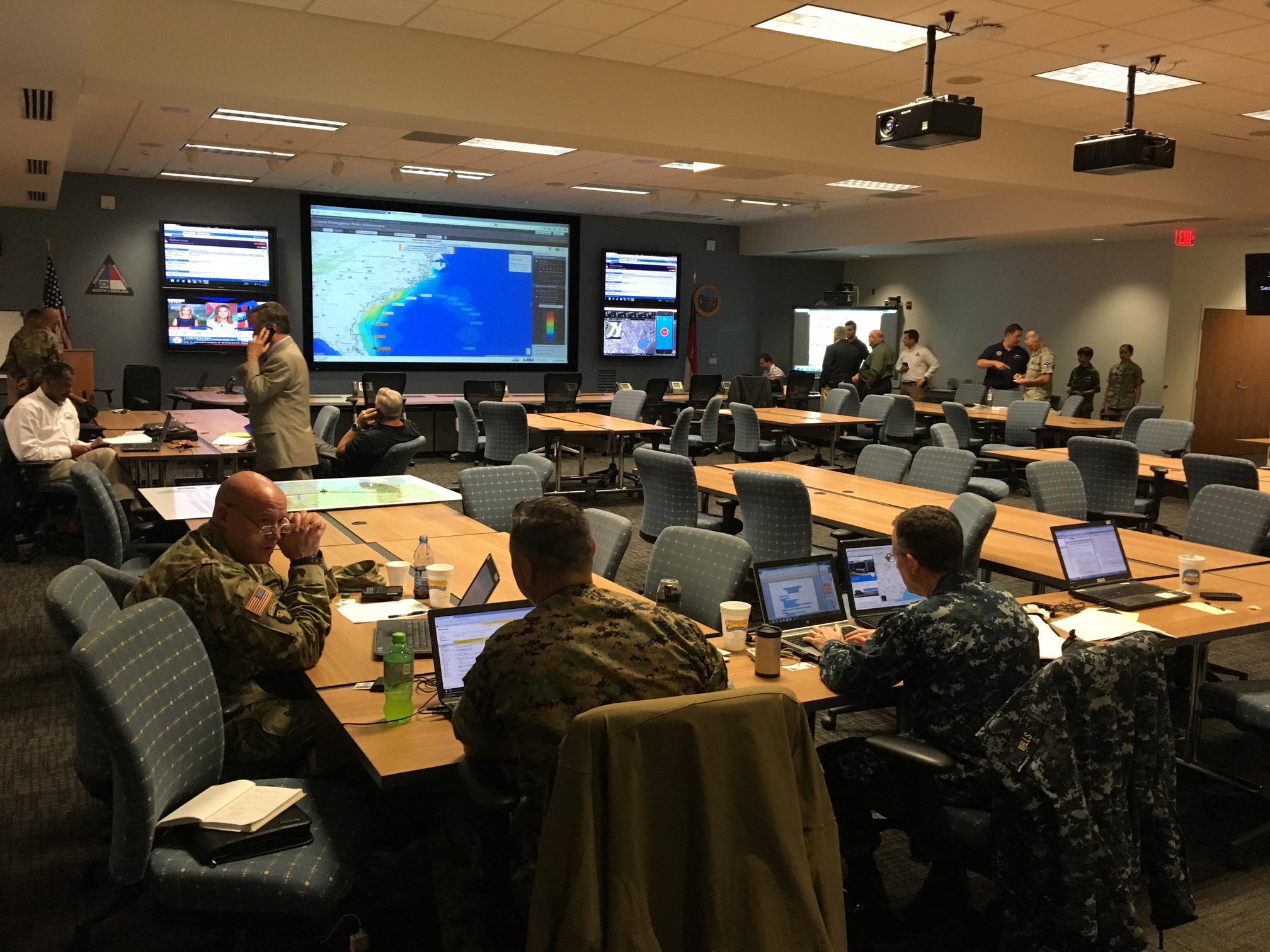
The CERA website is used during Hurricane Matthew preparations at the NCEM Emergency Operations Center.
2016/10/06 – CCEE
Dietrich Aiding Efforts to Forecast Flooding during Hurricane Matthew

As Hurricane Matthew approaches Florida and prepares to move up the U.S. east coast, researchers in North Carolina are running models to forecast the storm surge and coastal flooding. Dr. Casey Dietrich is working with collaborators at the University of North Carolina, the Renaissance Computing Institute, and Seahorse Coastal Consulting to generate and share guidance during the storm. The models are run every 6 hours, and they provide high-resolution forecasts of possible flooding throughout the NC coast. The forecasts can be found at: http://nc-cera.renci.org/. Dietrich is providing forecast guidance to NC Emergency Management, for use in decisions about evacuation and resource deployment. This real-time forecasting is part of a research project to downscale the model results and provide them in formats tailored to the needs of emergency managers.
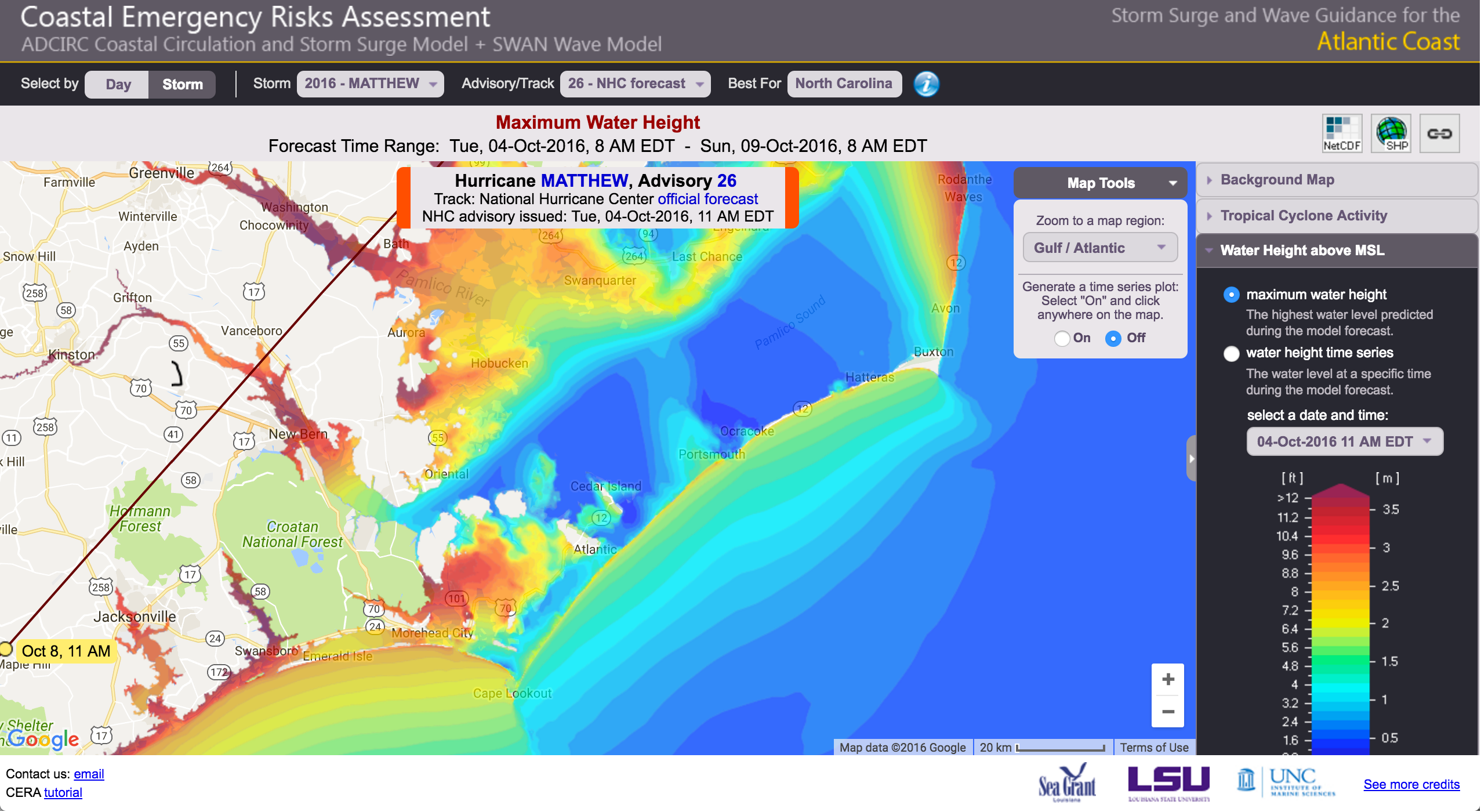
Forecast of coastal flooding due to Hurricane Matthew (2016).
In this web site, we share our research progress, from development to application, and from coding to publishing. Learn more about What We Do and how to Join Our Team.
Many new users of SWAN+ADCIRC, after reading the instructions on how to compile and run the coupled models, have asked for example input files to test their implementation. While we have posted an example application of Hurricane Gustav (2008), that example will require a small parallel cluster to run efficiently. There is a need for a smaller example that can be run in serial.
This example is much smaller, and it includes coverage of the Albemarle-Pamlico Estuarine System (APES) along the North Carolina coastline. The mesh has only 1,069 vertices, and thus it can be run in serial in less than 10 min. The example is a hindcast of Hurricane Irene (2011), which moved over this system and caused waves and surge inside the shallow sounds and estuaries.
The entire set of example input files is: Irene-APES-v41.31.zip
The individual files are described below. They have been modified to be compatible with the latest versions of the codes, and to reflect our latest settings for SWAN and ADCIRC. These files are extremely coarse, both in the mesh resolution and the wind field, but they are a good starting point for new users of the coupled models.
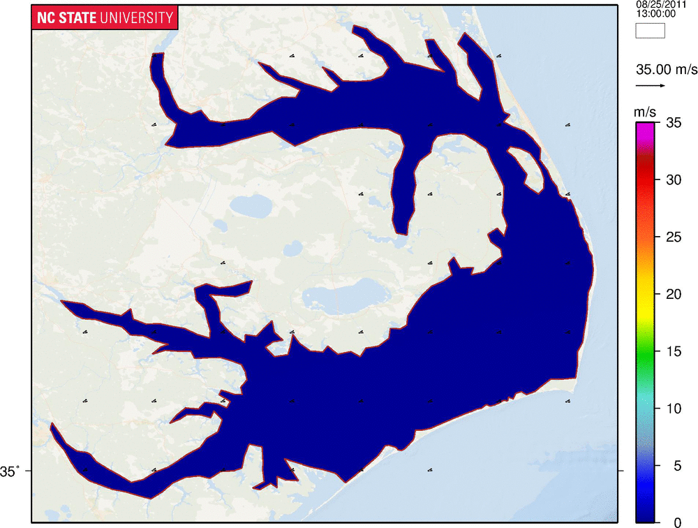
Contours and vectors of wind velocities (m/s) during Hurricane Irene (2011) in the Albemarle-Pamlico Estuarine System.