

News: Improving Coastal Flooding Predictions
2018/05/14 – NC Sea Grant Coastwatch Currents
Hurricane Hindsight: Researchers Work to Improve Coastal Flooding Predictions
Hurricane Hindsight: Researchers Work to Improve Coastal Flooding Predictions
Computer models can make surge predictions based on limited information about storm characteristics such as track, size, maximum wind speed and central pressure. Those parameters are used to predict the surface pressures and wind speeds throughout a coastal region. Those atmospheric conditions are then used to predict how the ocean will respond by generating large waves and surge, and by flooding into low-lying areas.
Given all the variables involved, there’s a lot of room for error in storm wind and surge prediction modeling.
For our study, we wanted to know how forecasting errors affect subsequent coastal flooding predictions. To that end, we needed to answer a couple of questions: First, as a storm moves closer to the coast, how accurate are forecasts of certain storm parameters like track, size, and maximum wind speed? Second, how do those forecasts affect predictions of wind speeds and storm surge?
News: Outstanding Teacher Award
2018/05/14 – NCSU Civil, Construction, and Environmental Engineering
Two CCEE Professors inducted into the Academy of Outstanding Teachers
Two CCEE Professors inducted into the Academy of Outstanding Teachers

Teaching students from a wide range of experiences and interests, Dietrich has incorporated dynamic, team-based methods in his courses. He believes that students learn best by doing, and encourages students to become active participants in the classroom. Using required reading to introduce students to course material, Dietrich uses class time to move toward incorporating the material into an activity or problem, which is addressed in teams. He prefers his class sessions to be more discussion oriented, and for students to experience the material in a supportive atmosphere.
2018/05/03 – NCSU College of Engineering
Bryant, de los Reyes, and Dietrich receive Outstanding Teaching Awards

[Dr. Dietrich] has contributed to the teaching mission of the department with his teaching of required courses, restarting the department’s teaching and research program in coastal engineering and improving the teaching of fluid mechanics at all levels. A former student wrote: “Dr. Dietrich is a fantastic professor and organizes his class in a refreshing way. Everything is posted online and all one needs to do is fill in the work for the examples. He is clear and concise when presenting the material and values the opinions of all the students. He emphasizes group work, which is realistic in the real world.”
2018/04/11 – NCSU Executive Vice Chancellor and Provost
2017-2018 University Teaching Awards Presented

NC State recognized more than 30 faculty for their dedication to teaching, mentoring and innovation at the 2017-2018 University Teaching Awards Ceremony on April 4. The Outstanding Teacher Award was presented to the following faculty members:
- Casey Dietrich, Department of Civil, Construction, and Environmental Engineering
The award recognizes excellence in teaching at all levels. Faculty must receive the Outstanding Teacher Award in order to be eligible for the Board of Governors Award for Excellence in Teaching and the Alumni Distinguished Undergraduate Professor Award. Recipients of the Outstanding Teacher Award become members of the Academy of Outstanding Teachers for as long as they remain NC State faculty. Recipients’ names are published in the commencement program.
Conference: ADCIRC 2018
CCHT Joins COPRI Field Trip to Wilmington-Area Beaches
CCHT members led the annual field trip by the Coasts, Oceans, Ports, and Rivers Institute (COPRI) student chapter at NC State University. The chapter traveled to Wilmington, NC, over two days to visit beaches from Ocean Isle to Kure through Wrightsville. The students learned about beach management practices from Greg Williams and his team at the Wilmington District of the US Army Corps of Engineers, as well as from NC Sea Grant extension specialist Spencer Rogers.
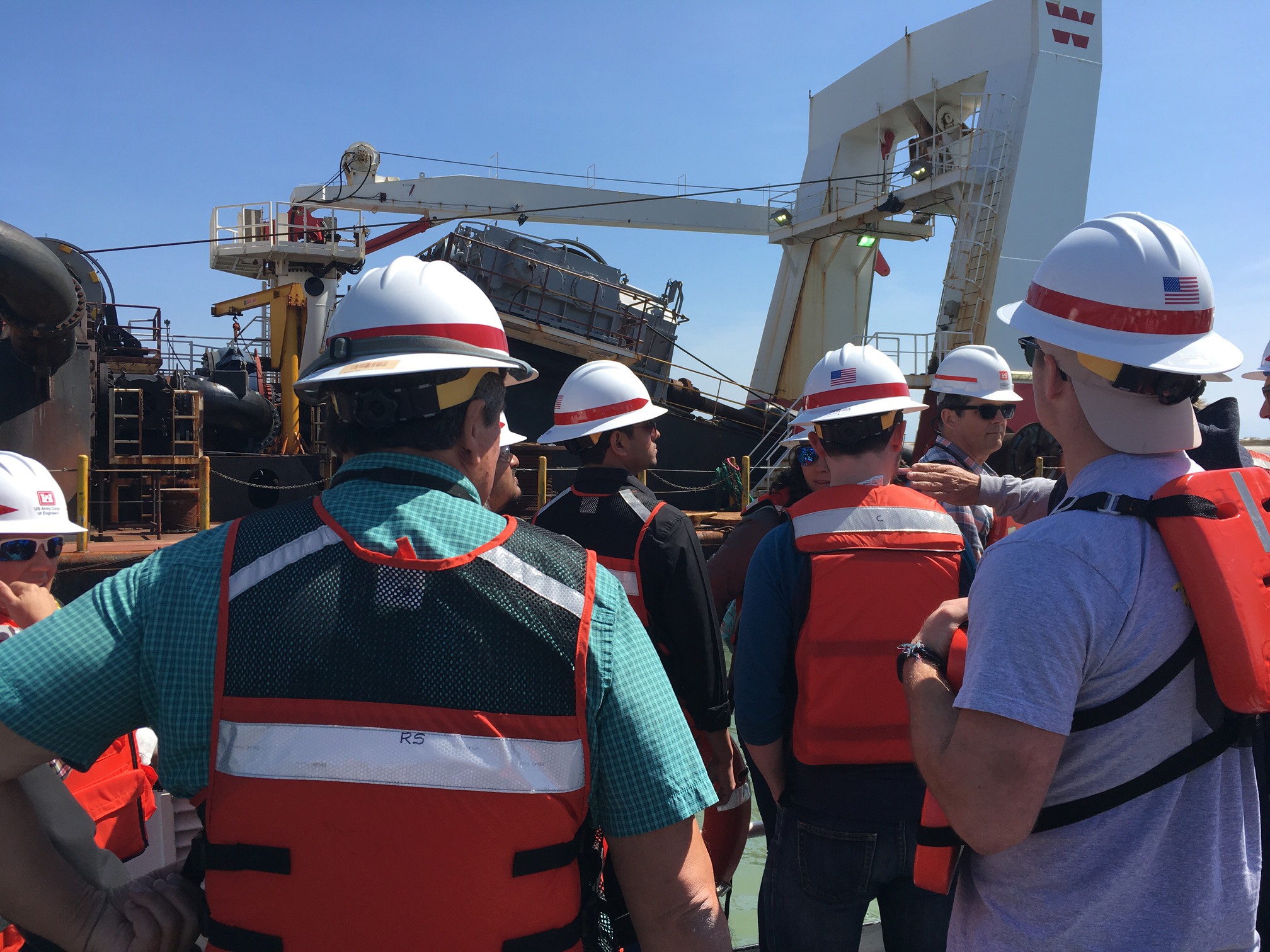
During the first day of the visit, the students visited an active dredge as it finished a beach nourishment project on Ocean Isle. The tour included a visit onto the dredge to learn how it operates, and also to the beach to see how the pumping is controlled and how the sand is worked to meet the design specifications. During the second day, the students visited several beaches closer to Wilmington to learn about terminal groins, nourishment projects, inlet stabilization, and construction practices.
This was the second annual field trip for the COPRI student chapter. During the 2017-2018 academic year, CCHT members served as President (Nelson Tull), Vice President (Rosemary Cyriac), and Treasurer (Alireza Gharagozlou).
Students preparing to board the dredge near Ocean Isle, during the 2018 COPRI field trip.
Casey wins Outstanding Teacher Award
Casey Dietrich received the NC State Outstanding Teacher Award, which recognizes excellence in teaching at all levels across the university. Faculty members are nominated by their departments, and then finalists are recommended by their colleges. During 2017-2018, the award was given to 17 instructors, or less than 1 per 100 faculty members at NC State.
Recipients of the Outstanding Teacher Award become members of the Academy of Outstanding Teachers for as long as they remain NC State faculty. Recipients are recognized at the Teaching Awards Ceremony in the Spring, and their names are published in the NC State Bulletin and Commencement Program.
This is a great honor, and it reflects Casey’s hard work to implement active, team-based learning in the undergraduate course in fluid mechanics, as well as to establish a set of graduate courses in coastal engineering. He has enjoyed working with students at all levels at NC State.
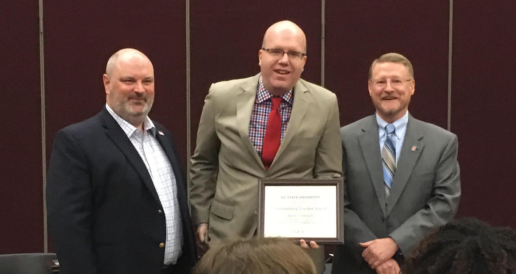
Casey Dietrich accepts the award at the NC State Teaching Awards Ceremony, with (left) Rudi Seracino, Professor and Associate Head for Undergraduate Programs, and (right) Duane Larick, Senior Vice Provost for Academic Strategy and Resource Management.
Poster: Graduate Student Research Symposium 2018
A Thomas, JC Dietrich, JG Fleming, BO Blanton, T Asher, RA Luettich. “High-Resolution Modelling of Surge during Hurricane Matthew (2016).” Graduate Student Research Symposium, North Carolina State University, 21 March 2018.
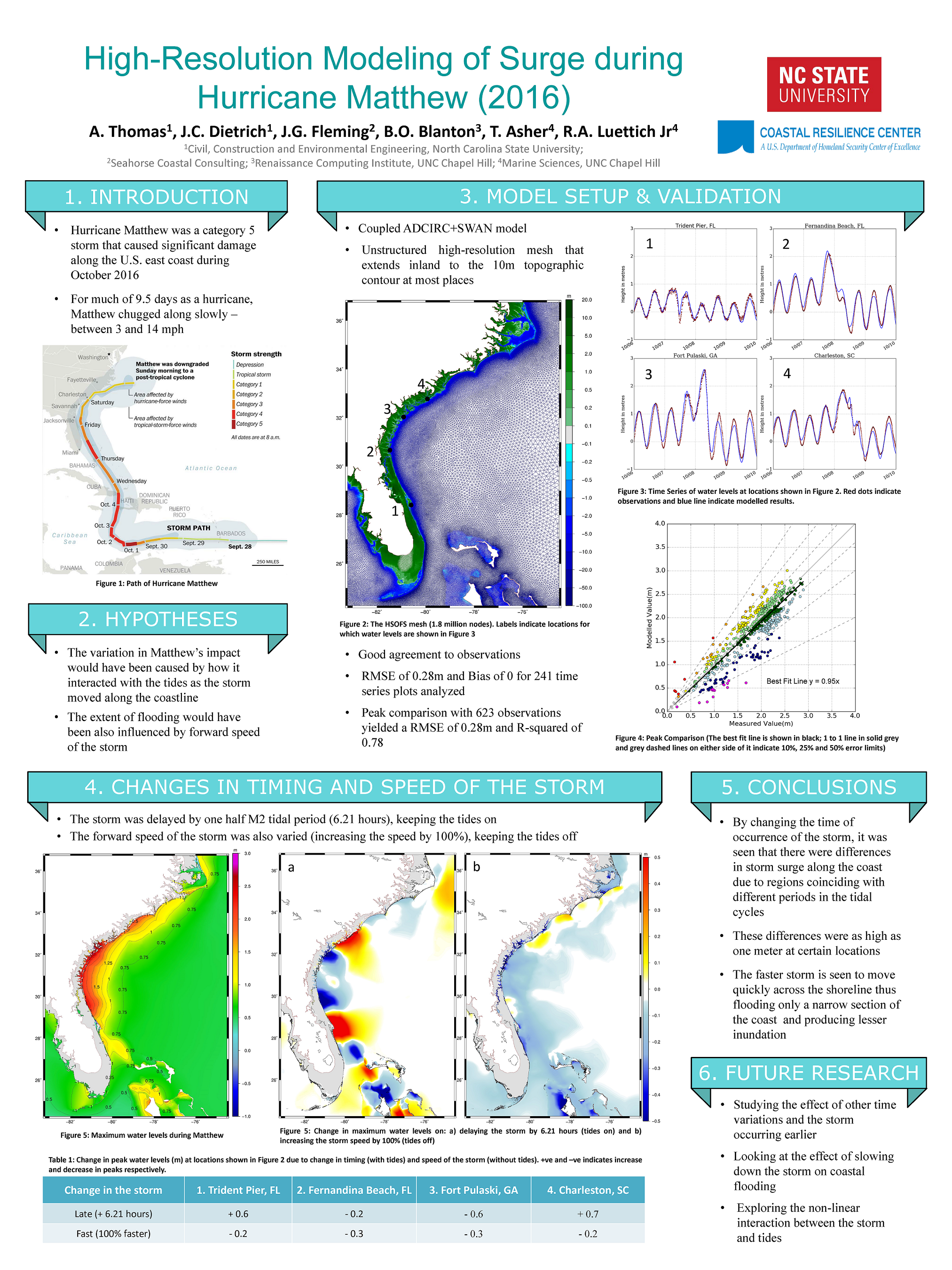
High-Resolution Modelling of Surge during Hurricane Matthew (2016).
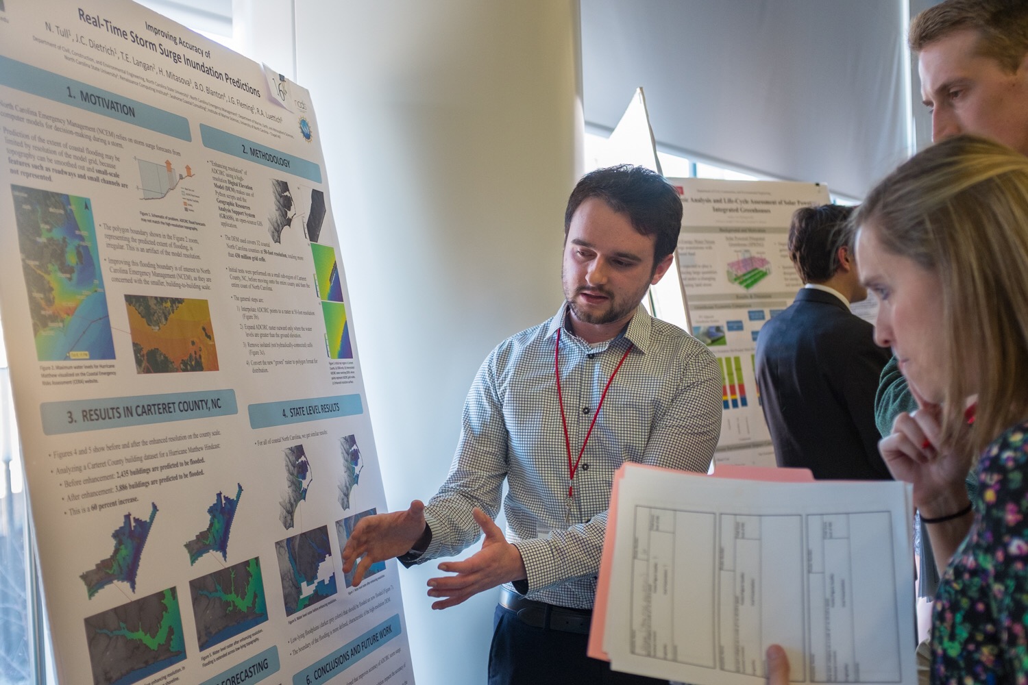
Nelson and Ajimon win Student Poster Awards
MS student Nelson Tull won First Place in the Student Poster Competition at the EWC Research Symposium. Nelson described his research to enhance resolution of coastal flooding forecasts for decision support.
PhD student Ajimon Thomas won Honorable Mention. Ajimon described his research to quantify interactions between tides and storm surge along the U.S. southeast coast during Hurricane Matthew.
This event is an annual showcase for research in our Environmental, Water Resources, and Coastal (EWC) engineering group, as well as a recruiting event for potential students. Awardees are selected by judges from other academic departments, government agencies, and consulting firms. Students presented their posters to judges and visitors during a poster session, and then finalists presented orally to the entire audience.
Congratulations to Nelson and Ajimon!
Nelson Tull shares his poster with judges at the 2018 EWC Research Symposium.