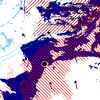
 After the destruction of the Deepwater Horizon drilling platform during the spring of 2010, the northern Gulf of Mexico was threatened by an oil spill from the Macondo well. Emergency responders were concerned about oil transport in the nearshore, where it threatened immediately the fishing waters and coastline from Louisiana to Florida. In this region, oil movement was influenced by a continental shelf with varying width, the protruding Mississippi River delta, the marshes and bayou of southern Louisiana, and the shallow sounds and barrier islands that protect the coastline. Transport forecasts require physics-based computational models and high-resolution meshes that represent the circulation in deep water, on the continental shelf, and within the complex nearshore environment.
This work applies the coupled SWAN+ADCIRC model on a high-resolution computational mesh to simulate the current velocity field on the continental shelf, nearshore and marsh areas during the time that oil was visible on the surface of the Gulf. The SWAN+ADCIRC simulations account for the influence of tides, riverine discharge, winds and wind-driven waves. A highly-efficient Lagrangian particle transport model is employed to simulate the surface trajectories of the oil. The transport model accounts for dispersion and advection by wind and currents. Transport is evaluated using two week-long sequences of satellite images. During both periods, the SWAN+ADCIRC current fields alone appeared to be more successful moving the oil than when direct wind forcing was included. In addition, hypothetical oil transport is considered during two hurricane scenarios. Had a hurricane significantly impacted the areas, depending on its track, oil would have moved farther into the marshes of southern Louisiana or farther along the shelf toward Texas than actually occurred during the spill.

