Kalpana converts ADCIRC output files in netCDF format to Google Earth (kmz) or GIS shapefiles for use with conventional GIS software. The latest version of the code is maintained at our GitHub repository: https://github.com/ccht-ncsu/Kalpana.
Command line arguments control the way it produces output, including the number of contour levels, their values, and the color scale. When these specifications are absent from the command line, it uses reasonable default settings so in many cases only a few of the available command line options will be used for any particular plot.
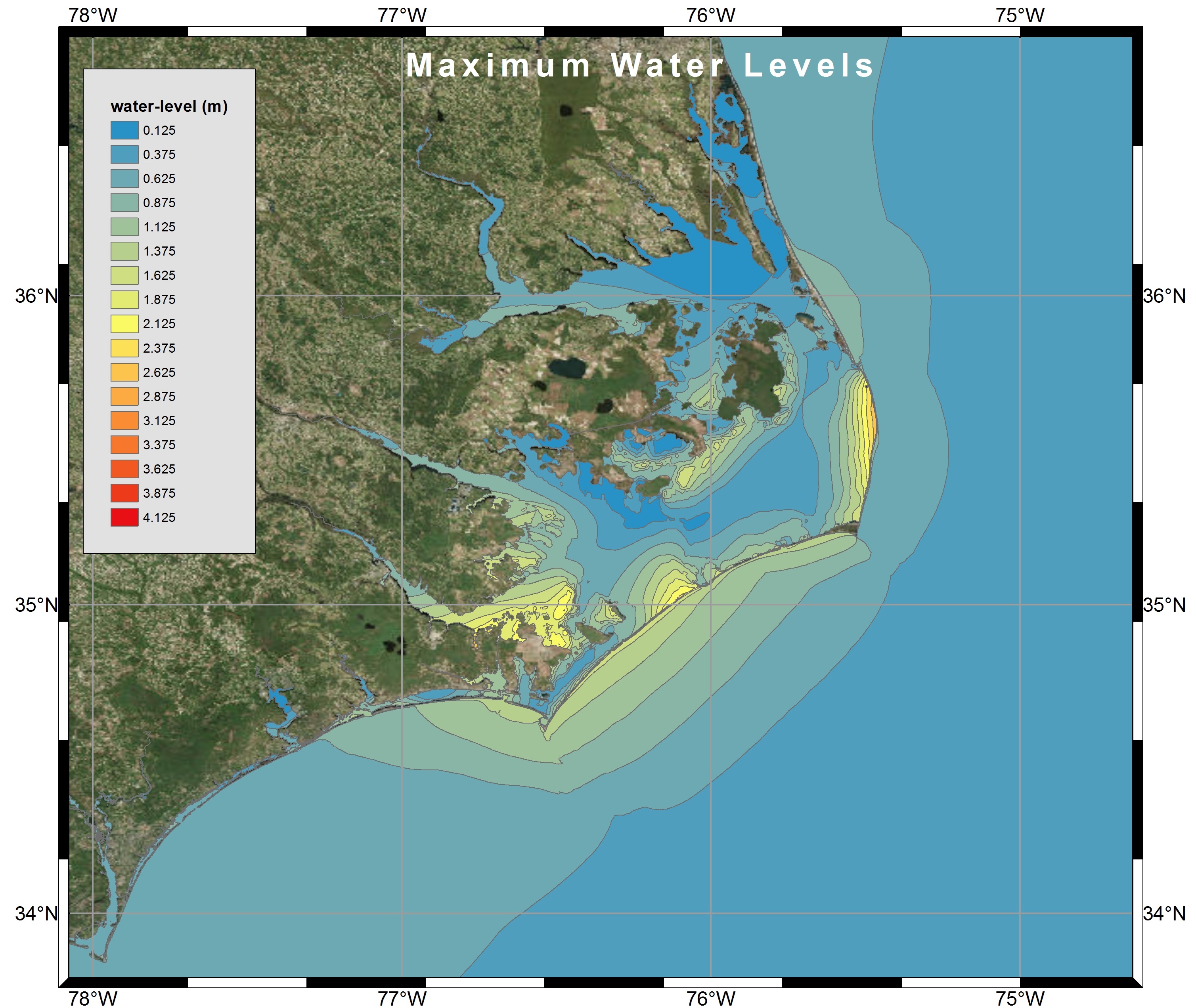
Visualization of Maximum Water Levels along the North Carolina coast during Hurricane Arthur (2014) using polygon shapefiles created by Kalpana with ArcGIS satellite imagery.