These instructions were developed by undergraduate researcher Hunter Hudson.
Kalpana can be used visualize and downscale ADCIRC predictions of storm surge and flooding, with documentation in a recent journal manuscript and examples in its GitHub repository. For downscaling, ADCIRC predictions can be mapped from the model resolution (e.g. 50 to 100 m or larger in coastal regions) to higher resolutions (e.g. 10 m or smaller in a DEM). The downscaled flood map is a better representation of the hazard.
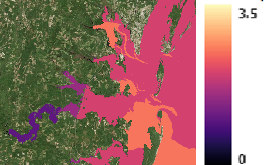
Maximum water levels along the Georgia coast due to Hurricane Matthew (2016) as visualized by Kalpana.
However, as an input for downscaling, Kalpana requires a raster DEM as a target. DEMs can be quite large, and thus it can be challenging to store and share them for other users. It is better for each user to develop their own DEM, with a specific focus to their region of interest and a specific resolution. On this page, we provide information about how to create DEMs for use with Kalpana.
Please continue reading for information on how to construct DEMs!