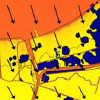
Hurricane Katrina caused devastating flooding in St. Bernard Parish, Louisiana. Storm surge surrounded the polder that comprises heavily populated sections of the Parish in addition to the Lower 9th Ward section of Orleans Parish. Surge propagated along several pathways to reach levees and walls around the polder’s periphery. Extreme water levels led to breaches in the levee/wall system which, along with wave overtopping and steady overflow, led to considerable flood water entering the polder. Generation and evolution of the storm surge as it propagated into the region is examined using results from the SL15 regional application of the ADCIRC storm surge model. Fluxes of water into the region through navigation channels are compared to fluxes which entered through Lake Borgne and over inundated wetlands surrounding the lake. Fluxes through Lake Borgne and adjacent wetlands were found to be the predominant source of water reaching the region. Various sources of flood water along the polder periphery are examined. Flood water primarily entered through the east and west sides of the polder. Different peak surges and hydrograph shapes were experienced along the polder boundaries, and reasons for the spatial variability in surge conditions are discussed.
BA Ebersole, JJ Westerink, S Bunya, JC Dietrich, MA Cialone (2010). “Development of Storm Surge Which Led to Flooding in St. Bernard Polder during Hurricane Katrina.” Ocean Engineering, 37, 91-103.
 Hurricane Katrina caused devastating flooding in St. Bernard Parish, Louisiana. Storm surge surrounded the polder that comprises heavily populated sections of the Parish in addition to the Lower 9th Ward section of Orleans Parish. Surge propagated along several pathways to reach levees and walls around the polder’s periphery. Extreme water levels led to breaches in the levee/wall system which, along with wave overtopping and steady overflow, led to considerable flood water entering the polder. Generation and evolution of the storm surge as it propagated into the region is examined using results from the SL15 regional application of the ADCIRC storm surge model. Fluxes of water into the region through navigation channels are compared to fluxes which entered through Lake Borgne and over inundated wetlands surrounding the lake. Fluxes through Lake Borgne and adjacent wetlands were found to be the predominant source of water reaching the region. Various sources of flood water along the polder periphery are examined. Flood water primarily entered through the east and west sides of the polder. Different peak surges and hydrograph shapes were experienced along the polder boundaries, and reasons for the spatial variability in surge conditions are discussed.
 Hurricane Katrina caused devastating flooding in St. Bernard Parish, Louisiana. Storm surge surrounded the polder that comprises heavily populated sections of the Parish in addition to the Lower 9th Ward section of Orleans Parish. Surge propagated along several pathways to reach levees and walls around the polder’s periphery. Extreme water levels led to breaches in the levee/wall system which, along with wave overtopping and steady overflow, led to considerable flood water entering the polder. Generation and evolution of the storm surge as it propagated into the region is examined using results from the SL15 regional application of the ADCIRC storm surge model. Fluxes of water into the region through navigation channels are compared to fluxes which entered through Lake Borgne and over inundated wetlands surrounding the lake. Fluxes through Lake Borgne and adjacent wetlands were found to be the predominant source of water reaching the region. Various sources of flood water along the polder periphery are examined. Flood water primarily entered through the east and west sides of the polder. Different peak surges and hydrograph shapes were experienced along the polder boundaries, and reasons for the spatial variability in surge conditions are discussed.

