

Category Archives: Models
Simulating Hurricane Storm Surge in the Lower Mississippi River under Varying Flow Conditions
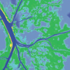 Hurricanes in southeastern Louisiana develop significant surges within the lower Mississippi River. Storms with strong sustained easterly winds push water into shallow Breton Sound, overtop the river’s east bank south of Pointe à la Hache, Louisiana, penetrate into the river, and are confined by levees on the west bank. The main channel’s width and depth allow surge to propagate rapidly and efficiently up river. This work refines the high-resolution, unstructured mesh, wave current Simulating Waves Nearshore + Advanced Circulation (SWAN+ADCIRC) SL16 model to simulate river flow and hurricane-driven surge within the Mississippi River. A river velocity regime–based variation in bottom friction and a temporally variable riverine flow-driven radiation boundary condition are essential to accurately model these processes for high and/or time-varying flows. The coupled modeling system is validated for riverine flow stage relationships, flow distributions within the distributary systems, tides, and Hurricane Gustav (2008) riverine surges.
News: Large-Scale Simulations of Coastal Flooding
2013/04/04 – The Daily Texan
UT research group uses math, simulations to analyze hurricanes
by Mark Carrion
UT research group uses math, simulations to analyze hurricanes
by Mark Carrion

Casey Dietrich is one of 14 researchers besides Dawson who works in the research group. He said having access to Stampede, UT’s new and powerful supercomputer, is important for the simulations the group runs.
“We’re very lucky we get access to one of the largest supercomputers in the world,” Dietrich said. “That opens the door for us to run larger, more interesting problems.”
Dietrich said the models they run use calculations from Stampede that allow them to analyze changes in an area as small as 20 meters.
“We can really see how the flooding is affecting the environment,” Dietrich said.
Conference: FEF 2013
JC Dietrich, CN Dawson, H Arabshahi, A Muhammad. “Coastal Models of Oil Transport in the Gulf of Mexico during Normal and Extreme Conditions.” Advances in Computational Mechanics, with special track: Finite Elements in Flow Problems, San Diego, California, 24-27 February 2013.
Please click here for more information about the FEF 2013 conference.