Developing Storm Surge Visualization

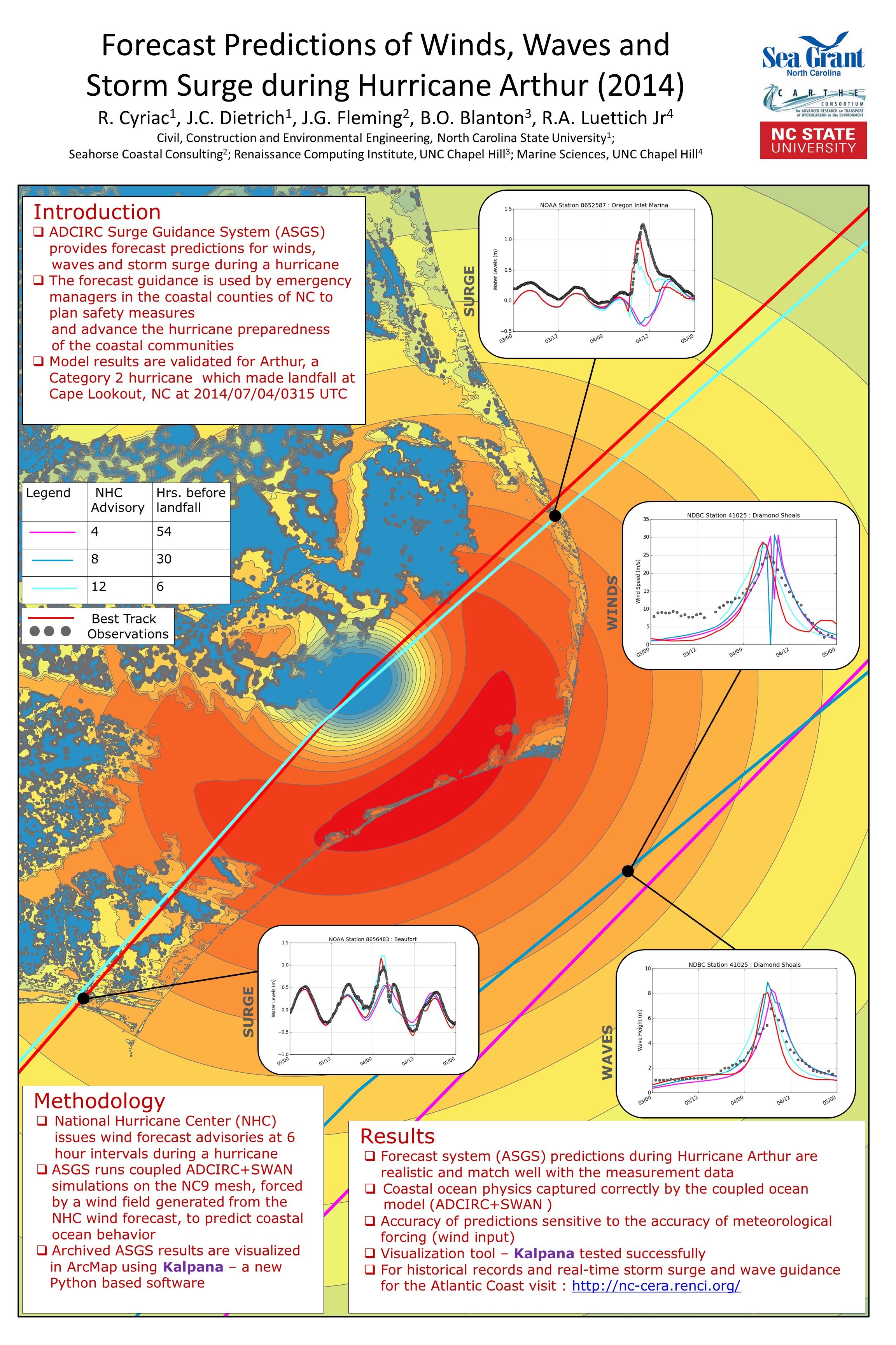
When tropical storms approach, local, state and federal emergency managers seek predictions of storm surge and coastal flooding. In a project supported by NC Sea Grant, Dr. Casey Dietrich and Ph.D. student Rosemary Cyriac are improving the dissemination of flooding predictions to end-users by producing predictions in popular file formats. The Coastal Emergency Risk Assessment (CERA, http://nc-cera.renci.org/) provides a Web-based interface for visualizing surge predictions from computer models. Dr. Dietrich’s team is working with emergency managers in North Carolina’s coastal counties and with other decision makers. Results from daily model simulations are sent to these individuals, and they are widely used to predict inundation and flooding levels. Such predictions are also needed for engineering design and evacuation decisions. Model outputs are converted into formats compatible with commonly used visualization software, such as ArcGIS and Google Earth. By providing predictions to local emergency managers in a useful format, the information can be more easily integrated with other data, thereby making the information more accessible to those who most need it.